PCT Days 110 to 119 - From Smoke and Sickness to Volcanic Views

Day 110
Despite our late night at the theater, Anna and I were both up around 6am since we’re so used to getting up early on the trail. Once we were fully roused and she had finished at least 2 cups of coffee, we grabbed Bush and headed to the Ashland Co-op for some more amazing breakfast sandwiches and pastries. There, we discussed updates to the fires around us, getting back on trail, and potential routes around problem areas. Satiated, we headed back to The Columbia, packed up, charged up, had some last-minute showers, and headed out. Jo, the incredibly friendly South African woman running The Columbia, gave us a ride back to the trail in her awesome 2004 Subaru Forester. On the way back, we passed the actively burning 125 acre Neil Creek fire (which had started the night we got into town) along the side of I-5. Once we were dropped off at the trailhead on OR273, we realized just how smoky the air was around us. Jacqueline (who we had not seen since Kennedy Meadows South!) was there waiting for the rest of her crew, so we quickly traded numbers and then hit the trail, hiking fast since we were fresh and we wanted to get ahead of any chance of the fire spreading across the interstate.
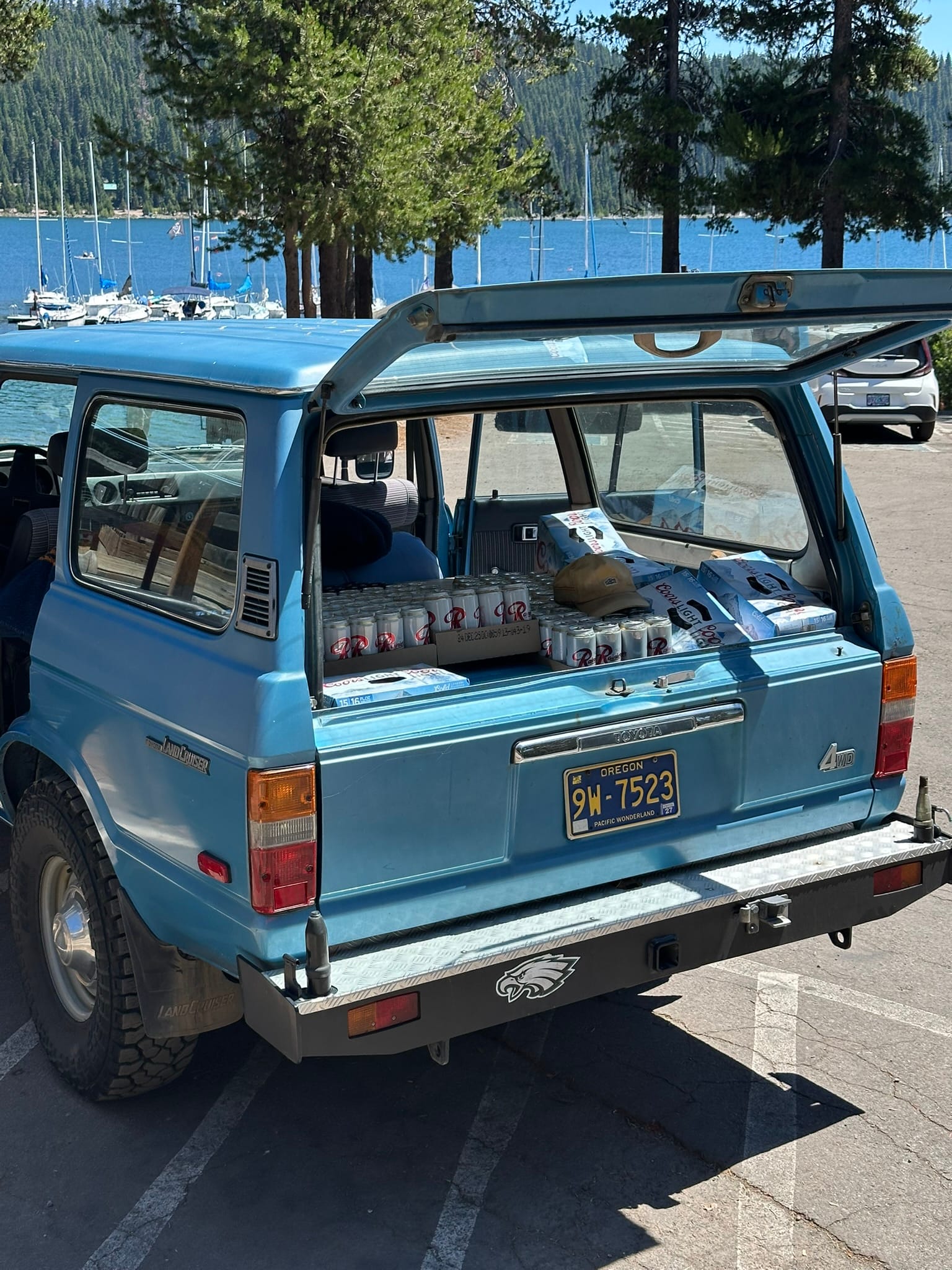
The trail was nicely forested and covered, which helped to shade us from some of the sun’s heat as it was already around 10am. Unfortunately, it was quite overgrown in areas, and the visibility was crap due to the smoke. As a result, I think we all kind of just put our heads down and sweated out the miles. Near Pilot Rock at mile 1725.5, we stopped for a brief lunch and water planning break before continuing on. We also checked the status of an on-trail fire ahead of us that had not been mapped, but there were zero updates. We all grabbed full water at mile 1731.6 in anticipation of dry camping, and while we were there, we encountered some very brazen deer! From there, we found a nice road cut off ahead and decided to meet there. The next hour or so, we all put our headphones in until we arrived at Green Springs Summit Road at mile 1737.1. We then hiked the road for a while until just before Little Hyatt Reservoir, when a local named John offered us a ride up the road. Never ones to look a gift horse in the mouth, we hopped in the bed of his truck and rode up to Hyatt Reservoir, just next to the Hyatt Lake Resort. I can’t believe it’s taken this long on the trail to ride in the bed of a truck! We thanked him profusely, and then continued on the remaining mile or so to Hyatt Lake Campground, just off the trail at mile 1744.2. Once we got to the PCT camping area, we ran into Clammy, who we had not seen since Idyllwild! What a day for reunions! We all had dinner together and caught up, then I took advantage of the campground's hot showers. We’ll unfortunately hit the fire pretty early tomorrow morning, but I’m confident we’ll find an easy way around. All of this is to say, despite the heat and fires, it’s wonderful to finally be enjoying the trail again!
Day 111
Due to our long day yesterday, we slept in a tiny bit and hit the trail a little after 6am. It was amazing being able to use bathrooms with running water and have access to a water spigot on our way out. The first 3ish miles, Anna and I took a nice flat road that ran between the trail and Hyatt Lake. Once we hopped on the trail, we cruised along on the soft pine duff until we came upon the fire around mile 1749. We bushwhacked to try to find a road marked on Caltopo, but when we located it, it had long been reclaimed by the forest. We did however, find the wildland firefighters’ bulldozed fire break, so we hiked on that instead. The break was spongy and silty, so it was a bit annoying to hike on, but it kept us out of the smoldering embers just off to our right. Once we got to the end, we found Bush, who had hiked THROUGH the smoldering remnants of the fire. He showed us a cool picture of a burning tree that he dubbed “The Eye of Sauron”, while we stopped and had breakfast on a log. Fueled up, we headed up our only major climb of the day, 1700ft over 6ish miles. As we headed up, we were all sweating profusely from the sticky humidity. Most of the way up, we hopped off to grab water from a weird little piped spring off-trail that even had its own boardwalk!
Refreshed, we made it to the top, and then immediately headed back down 800ft… At the base, Bush managed to find a log that was neither sticky nor rotten for us to use for lunch. We were making good time, already having clocked about 15mi by 12:30. So after a short break, we pushed on, and stopped at the South Brown Mountain shelter at mile 1764.9 to grab water before a 10 mile dry stretch. As we sat there, we were all starting to feel a bit gassed from the midday heat, so we decided on a different stopping point for the day that was a bit closer. Since we were tired, we sat at the shelter for a bit and explored the inside of it. At one point, Clammy rolled up and began to pump some water into his filter bag, but like some slapstick comedy, the water seemed to go everywhere but in the bag! Hydrated and cooled off a bit, we pushed on, and after a few miles of stumbling over lava rock, we made it to our tentsite at 1768.7 at 4:30pm. As soon as everyone had their tents pitched, they were tucked in in no time at all! Another 25mi day in the books. It feels amazing to finally be putting down mileage again!
Day 112

With our early mornings, we’re really starting to notice the days getting shorter. Unfortunately, though, the temperatures are not decreasing as well… I slept poorly again due to a combination of high humidity and some large animal crashing through the trees somewhere between us and Clammy. Anna and I hit the trail around our usual time and discussed our options regarding the impending snow on our way up to Highway 140. We were considering going to Fish Lake Resort to have breakfast and use their wifi for trail conditions research, but we ultimately decided not to waste the time. Once we reached the highway, Bush and then Clammy caught up to us, and we all complained about the mosquitoes while we filtered water. We then set out and immediately hit our only sizeable climb of the day, a 1400ft climb over 4 miles. The climb itself wasn’t too bad, but the humidity and blowdowns made it especially annoying and sweaty. I started up my audiobook of The Fellowship of the Ring, so I was mostly tuned out on the way up. At the top, Anna and I stopped for a quick snack and to plan out the rest of our day. From there on, we followed the gently rolling trail and hopped over blowdowns until we hit Christi’s Spring at mile 1786.5. This was our last water for the day, so when we walked the side trail to the spring, we were a bit surprised to see a large group of other hikers. Especially considering we hadn’t really seen anyone in this section. When we walked up, Bush was chatting up another Australian, and Clammy was talking about moonshine on the AT. Classic. Once we fended off the bugs and cameled up, Bush, Anna, and I headed out and chatted until we stopped at a large tentsite at mile 1791.9 around 4pm. We probably could have gone further, but my foot was killing me, and I had a massive bleeding gash from a blowdown that needed my attention. So we set up early, and before too long, 4 of the others from the spring ended up joining us. It was nice to hang out during dinner, but I’m hoping they aren’t noisy sleepers!
Day 113
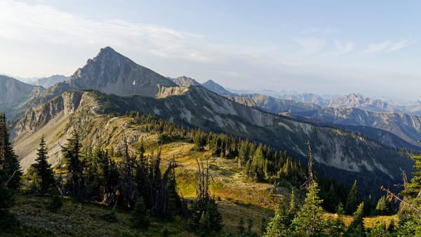
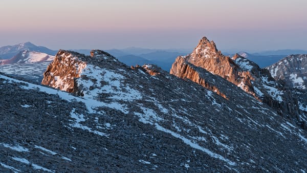
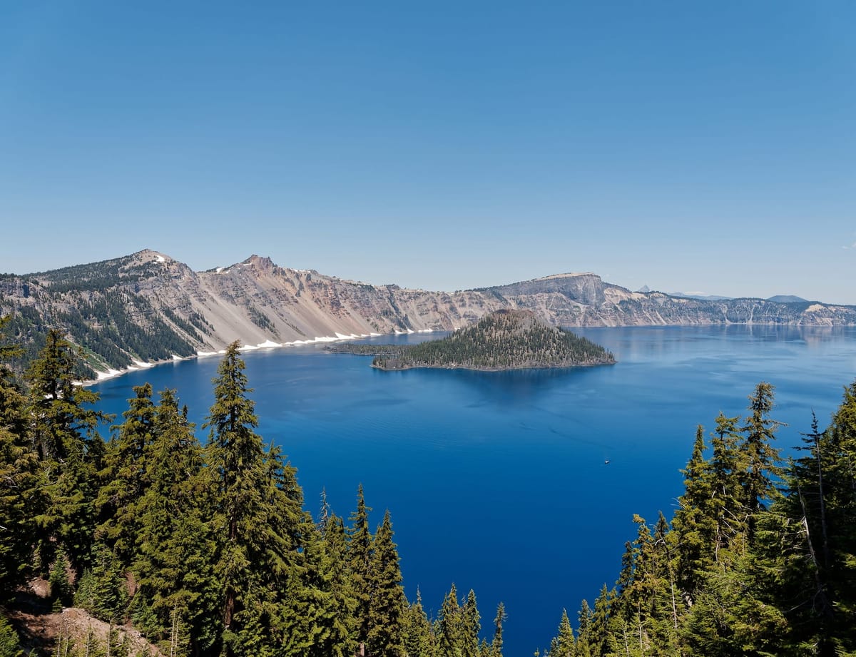
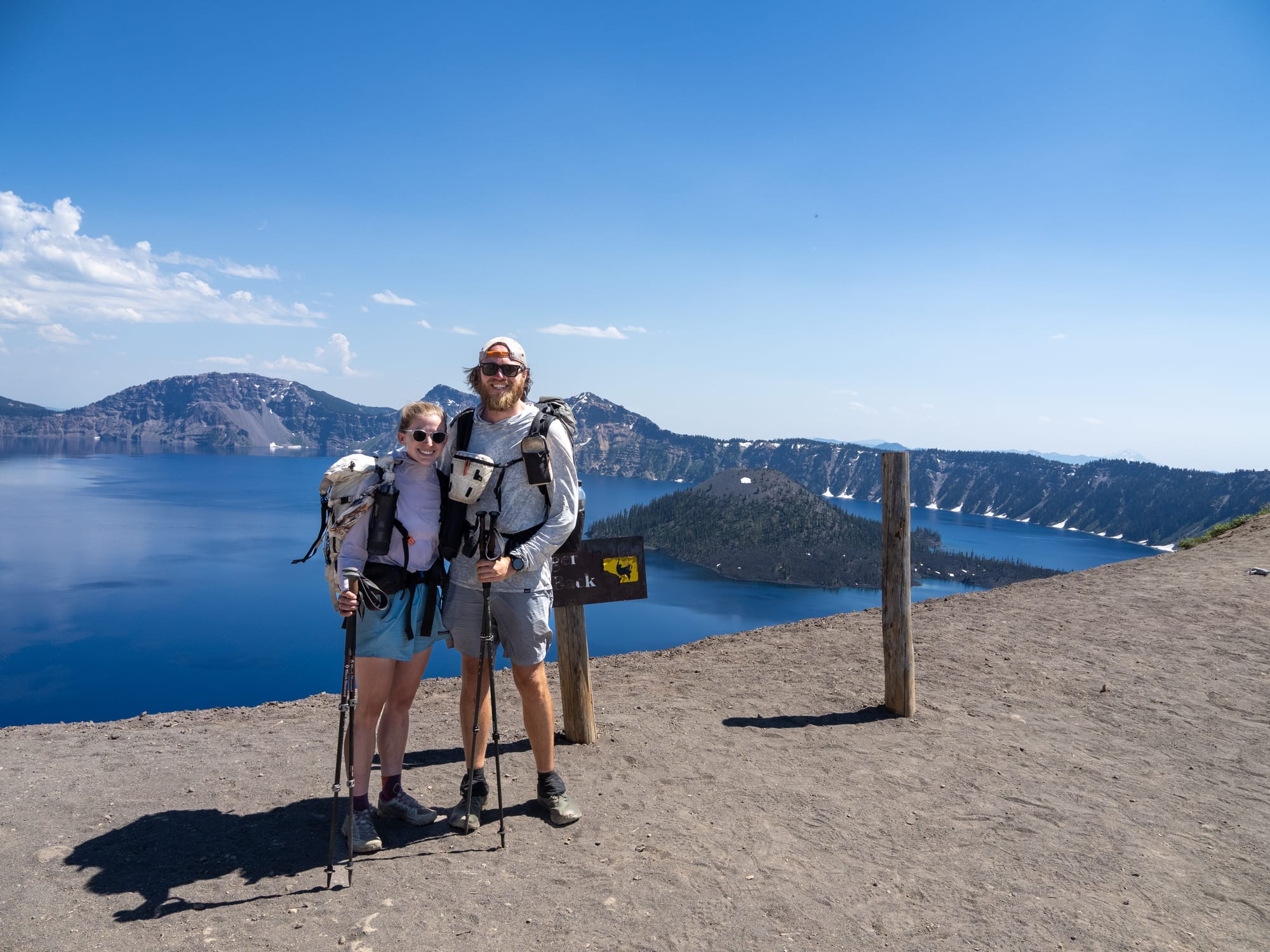
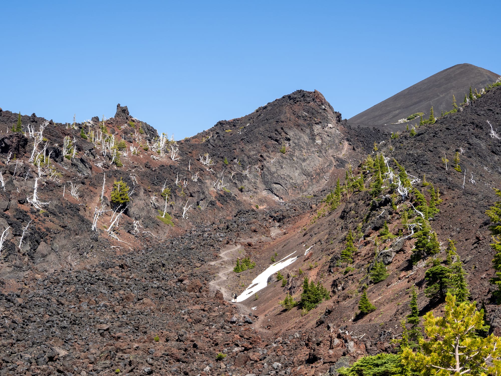
Worried that we would hit some gnarly snow traverses today, we set off a bit earlier than usual and quickly crushed the first 7 miles, which were weirdly buggy for the early morning. We easily knocked the 1700ft climb, which was our only major climb of the day, well before it started to really heat up in this exposed section. Right around Lucifer Peak, where we expected our first snow/ice traverse, we were happily surprised to find that, apparently, it had all melted out in the heat, leaving some easily walked across mud! This was a pretty cool area due to its higher elevation and jagged volcanic terrain. The smoke had also cleared up more, allowing us to get views of larger peaks in the distance. Just past the peak, we went over a saddle that took us around the top of Devil's Peak. It was here that we ran into a substantial amount of high-angle snow that was not safe to glissade down due to the base having melted out. We watched two guys ahead of us slip and slide their way down and waited for them to get to the base so that we wouldn’t inadvertently kick rocks on them. Once they were safely out of the way, Anna and I used their lines with some improvements of our own to carefully make our way down, using our microspikes, occasional patches of scree, and a few thawed-out handholds. About halfway down, Bush appeared! He had caught up with us, and in classic fashion, easily made his way down the tricky bit. Once we had all made it down the iced-over switchbacks, we easily cruised across the flatter sections and resumed our quick pace. At some point, Bush decided that he wanted to reach Crater Lake today, so he pushed on ahead of us while we took a short break. Once we had taken a rest for our poor, lava-rock-punished feet, we pushed on to the last water source of the day, a nasty, stagnant pond in a large burn area that was the color of Pepsi… We set up in the shade for our late lunch, acutely feeling the heat and the 18.5 miles we had already hiked that day. Bush was already there, taking a break as well, along with the two guys we had seen on Devil’s Peak. It was ungodly hot, and no one felt like leaving this little oasis of shade to brave the direct sun of the burn scar. Also, this was the last water source for 13.8 miles, so you either had to make it into town tonight or camel up. Anna and I took a nice, long break to let the sun get a bit of an angle on it and to plan out our afternoon. I had found a nice, long winter cross-country ski trail up ahead that would cut off a few hills to make getting into the Mazama campground at Crater Lake more feasible for tonight. Once we were confident in our plan, we each chugged a bunch of water, filled up all of our bottles, and then hit the exposed burn. The trail itself was relatively flat with the occasional blowdown, but the sun exposure was brutal. The 7.1 miles seemed like they took forever, and when we finally arrived at the ski trail, we were both dragging. Blissfully, the side trail appeared to be well-maintained and vegetated, so we happily hopped onto it. The 3ish miles from there to the road passed by quite quickly, and we soon arrived at State Highway 62. From old comments, we had been led to believe that we could easily walk or hitch the highway into the park, but man, had we been misled. Essentially, no berm or pullouts existed along the road, and not a single car even so much as slowed down when it passed by us. It’s important to note, too, that we were walking within the boundaries of the national park, so most of the drivers were blatantly ignoring the park's lower speed limit. Accepting our fate, we trudged the few miles into the park along the side of the road at a quick pace to try and catch dinner at the restaurant before it closed. We also wanted to get off this road before twilight set in, making it even more hazardous. After a few hours of diving off the road, we finally made it into the campground. We did take one side detour to check out Annie Creek Canyon, though, which was really cool. At the store, we found Bush and Clammy killing a case of beers, and we were delighted to learn that the restaurant was staying open later this evening so we would be able to get hot food. Huzzah! After dinner, we set up our in camp, and then I ventured out for a late-night shower so that I could enjoy it while everyone else was asleep. Unfortunately, something was up with the water heater, so it ended up being ice-cold. After the incredibly long and hot day, though, it felt nice to wash all of the sweat and volcanic ash off! All in all, we cranked out about 32.6 miles with around 4500ft up and 4700ft down, making this by far our longest day! It was also really nice to camp with everyone at Mazama Village (mile 1707.5).
Day 114
After our long day yesterday, we had opted for no alarms, so as a result, we both slept in until 7am. Anna hadn’t showered yet, and mine had been lackluster due to the cold water and lack of soap, so we hit the showers first thing. They were unfortunately still pretty gross, but the water was hot! After we rinsed off, we did sink laundry due to the park concessioner refusing to fix the laundry room for several years. Once our vaguely cleaner clothes were hung up, we grabbed our food bags and headed over to the restaurant for breakfast and to plan. Anna had a breakfast sandwich and a carafe of black coffee, while I had biscuits and gravy. Clammy was a few tables over, so he chatted with us while we ate and charged our stuff. Once he left, Anna determined it would take 3 days and some change to get to Shelter Cove, our next resupply point. We also noticed that the PCT in Crater Lake National Park went nowhere near the actual lake. There was a blue blaze up around the rim, but according to park staff, most of it was closed due to unsafe trail conditions. Armed with this info, we finished our chores and hung out in front of the store for a bit, hoping for a hitch up to the rim so that we could avoid road walking on the busy weekend day. While we sat and charged our electronics, Shady, Pace Car, Magellen, and a bunch of other hikers we knew arrived and chatted with us for a bit. Some nice guy came by and donated a bunch of food to us (unfortunately, after I had already splashed out for my overpriced resupply), and not long after, a nice couple asked if Anna and I wanted a ride up the road. Because their RV wasn’t ready to roll yet, Nicole gave us a ride up in their towed jeep.
At the top, we said goodbye to Nicole and then checked out the gift shop to see if I could find a bandana. No dice. From there, we hopped on the rim trail and hiked a little over a mile of it before we saw a closure, and then promptly grabbed a hitch around it to another part of the rim. There, we met up with Bush, had lunch, and he told us that Whiskey was going to meet us for dinner and that he was bringing hot dogs! Bush also informed us that the trail had been closed in one section due to someone falling from the crumbling ledge. After we took a few more pictures, we hopped back on the rim trail and hiked down to Highway 209, where Whiskey was waiting with Busch for Bush. We caught up a bit on his Japan travels and then hopped in the van, headed for some BLM land. He drove around a bit and explored this quarry looking spot. It was a pretty neat area, but it would have sucked for tenting due to all of the hot, exposed rock. So we moved to another site just off the PCT near mile 1849.5. Once set up, Bush grilled up the hot dogs and we all caught up until the bugs became too much to handle. All in all, an awesome day!
Day 115
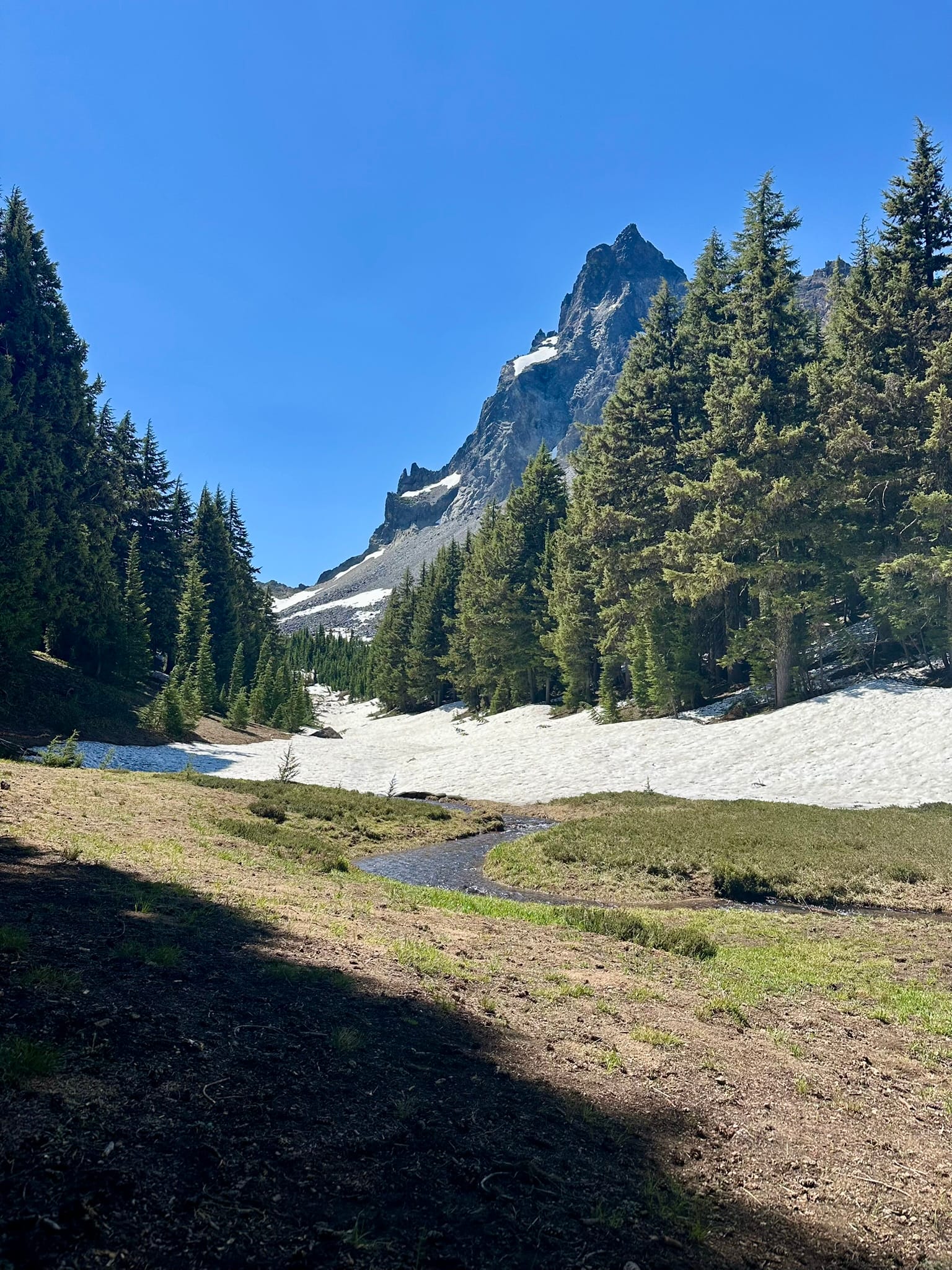
Since we had had a late night with Whiskey and Bush, neither Anna nor I had set alarm clocks, so we slept in a bit. Once we heard Bush stirring, we started packing up, said goodbye to Whiskey, and hit the trail around 7:40am. We pretty quickly hit the water cache at mile 1849.9 and filled up to max capacity since we had a large climb up towards Mt. Thielsen, our next water was 8 miles in, and we suspected that there might be a good amount of snow to traverse. I was feeling a bit under the weather, so I quickly fell behind the others. Once I lost sight of them, I put in my headphones and continued to listen to The Fellowship of the Ring, which is the perfect hiking audiobook. The climb started pretty sweaty due to the high humidity, but about half of the way up, the trail entered a gorgeous, shaded, dense forest that was cooled by the occasional snow patch. The climb ended up being mostly snow-free, thankfully making it quite enjoyable. At the top, I met back up with Anna and Bush at the intersection with the Mt. Thielsen summit trail, and had a very late breakfast. While we were sitting there, we noticed that after our next water, there was a 16-mile water carry…
Stomachs full, we continued on and almost immediately hit a ton of snow on the Northwest face of the mountain, which then ended up being almost continuous for the next 7 miles… Along the way, we found some excellent water at Thielsen Creek, and then trudged up the snow towards the highest point of the trail in the Oregon section. Around the high point, I started flagging considerably and noticed that my throat and head had begun to hurt progressively more. Regardless, we pressed on, eager to make it to our next water source. At one point, Bush received a call from Whiskey and announced that he was going to slam some pre-workout and meet Whiskey at Windigo Gap. Anna and I were cooked, so we kept our sights on Six Horse Spring. Eventually, the heat broke, and we had a wonderful breeze. Around the same time the breeze started, the mosquitoes came out in droves. When we finally arrived at the junction for the spring at mile 1873.6, I turned on our Thermacell and set up our tents and beds while Anna headed down to the spring. When she finally returned 40 minutes later, she had blood stains on her shirt and looked worn. Apparently, the spring was about half a mile straight downhill, and the whole thing was mosquito hell. All in all, we cranked out around 25 miles again, and man, are we shot.
Day 116
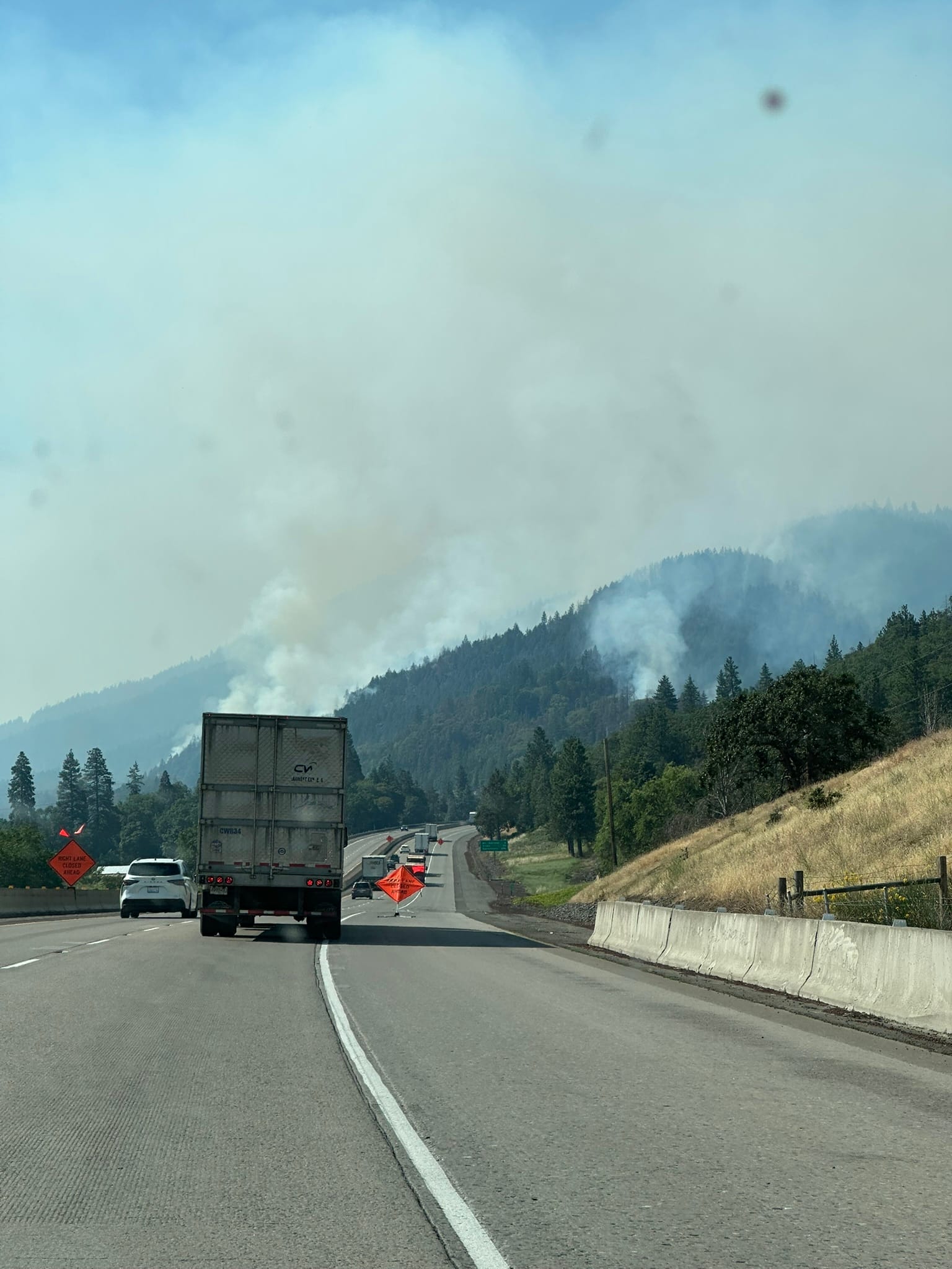
I woke up feeling much more under the weather than the previous day, with a monster headache and a sore throat. The mosquitoes outside the tent were horrendous, so we each had a quick snack before breaking camp, and then promptly left at a quick pace to avoid getting eaten alive. Outside of the bugs, the first few miles were pretty, but otherwise not very noteworthy. Right before we started the decline towards Windigo Gap, we noticed that off to the east, the sky looked incredibly hazy. After another mile or two, the haze arrived, and we could clearly smell smoke. Down at the gap, we found Whiskey and Bush handing out Busch beer and consuming a few themselves. We talked about how the smoke had seemingly blotted out the sun and that I was sick, so we collectively chose to take a day off. We all hopped in the van, hit a McDonald's for breakfast, and headed into Bend for the day. Bush and Whiskey ended up heading out to Smith Rock, but Anna and I grabbed a few days of food for our next stretch and then hung out at one of my favorite breweries in town, Worthy, had some of their Nashville Hot Chicken, charged our devices, and relaxed. As the day wore on, the smoke became significantly worse, almost turning into a heavy fog. Around 4pm, the boys came back and picked us up, and we headed back south to Shelter Cove at mile 1908.2. There, we grabbed an RV site, pitched our tents, and grilled out for the night, enjoying the breeze off the lake. Unfortunately, the smoke here was also incredibly bad, causing me to cough and hack most of the night. Apparently, there is a 30,000-acre brush fire a little ways northeast, and because the wind shifted, it’s blowing all the smoke towards us. It’s been great to just hang out today, especially while I’m sick with a cold, but I’m also very concerned about how bad the air is.
Day 117
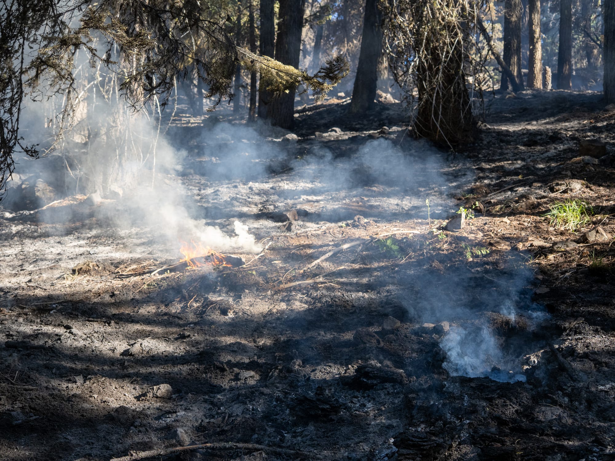
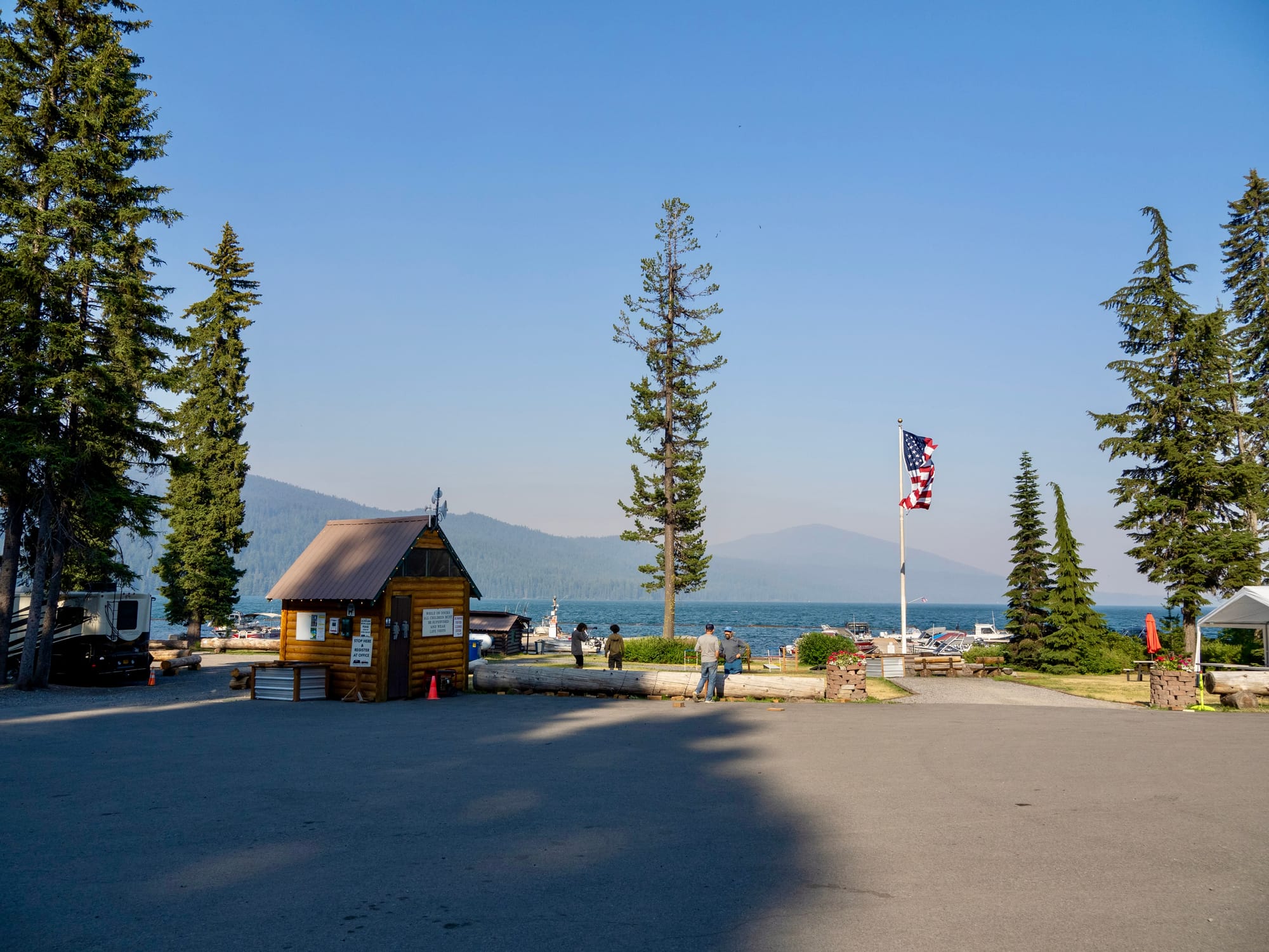
Unfortunately, I hardly slept throughout the night due to my cold getting worse. Between my sore throat, fever, congestion, and the heavy smoke, it was clear that I wasn’t hiking today. Shelter Cove cost money to camp at, and I really wasn’t interested in paying for a room, so I asked if Whiskey could drop me off at Elk Lake (mile 1954.1) to rest up. The stretch between Shelter Cove and Elk Lake was one big previous burn area, and with the smoke from the massive brush fire just north of Bend, it wasn’t going to clear up any time soon. The area north of Elk Lake would be geographically sheltered from the wind and smoke, though, due to the prevailing winds and the nearby Three Sisters peaks. Since we only had the one tent, Anna went with me, and we said goodbye to Bush who was going to hike through. On the drive up, Whiskey and I were blown away by how devastated this section was from previous fires. There were hardly even any dead grey trees remaining, just ash and the occasional deadfall. We arrived at Elk Lake still fairly early in the day, we said goodbye to Whiskey, and then I got tucked into one of their waterfront cabana couches. I spent most of the morning napping, sipping ice-cold Gatorade, and reading. The cold meds I had picked up seemed to be helping with the headache, but the smoke was still making it challenging to breathe clearly. As the day wore on, more and more weekenders showed up to jump into the gorgeous, clear lake. In the heat of the day, I ended up taking a long swim as well to try and cool off. I also took advantage of the wifi to catch up on blogging a bit as I have fallen way behind. The crowds seemed to die down around 5pm, so Anna and I picked up some cold drinks and then set up back in the lakeside cabanas to enjoy an early dinner before tucking in for the night back in the campground. I feel bad about having skipped a section, but with the nearby fire not at all being contained, my cold, and my general underlying respiratory issues, it will be a week or more before I could have hiked through that section. I also feel bad for causing Anna to skip as well, because we have both been loving Oregon. Hopefully, tomorrow I’ll start feeling better.
Day 118
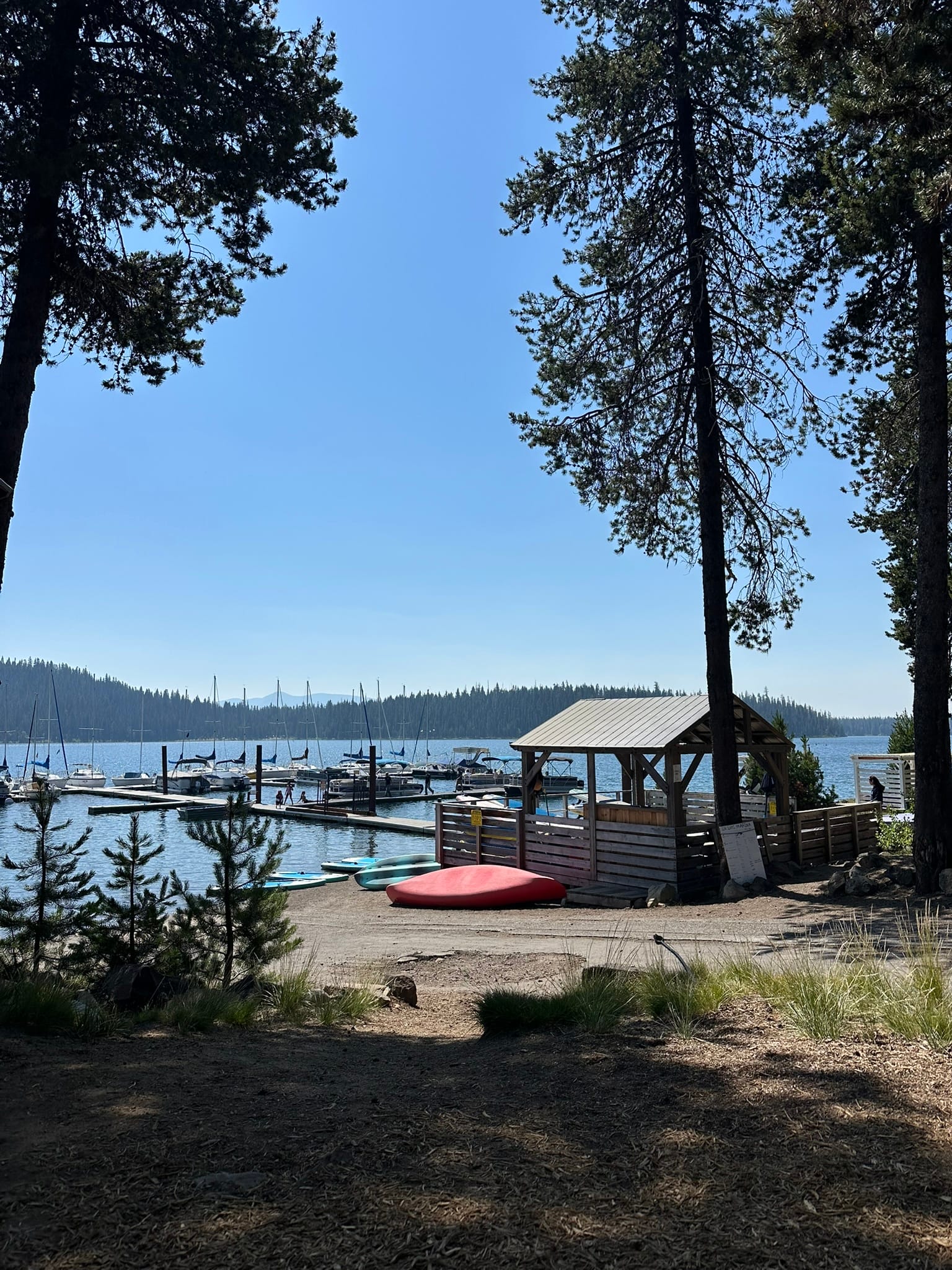
I ended up falling asleep early last night and slept in until 8am, meaning I got about 12 hours of sleep. This seemed to help immensely, although I still woke up feeling a bit worn out. Thankfully, the headache and fever seemed to be gone. Surprisingly, no one else in the campground appeared to be up yet, so I went down to the water and read for a while. At some point, Anna came down to join me, and we both had breakfast together along the water. Once the sun started to move further overhead, we retreated to the covered porch to charge our devices and plan out our Bend trip and Washington resupply boxes. We’ve never sent ourselves resupply boxes before, so we spent a ton of time coming up with mailing locations, food amounts, incidentals, etc. Later in the morning, the resort once again started to fill up with locals, making it hard to read and focus. Anna retreated to our tent in the woods, while I headed back to the lakeside to work on another blog post. Around lunch time, the large group on the patio took off, and our tent moved into the sun, so Anna and I regrouped at the patio. Some guys nearby gave us half of their pizza after claiming it was “too spicy,” but I passed all of it on to Anna. Since my stomach was finally feeling better, I rewarded myself with a milkshake, and then we finished hammering out Washington resupply plan. The whole time we had been there, there had been basically no other thru-hikers, so we were excited when Bush and a whole slew of people walked in a bit after 2pm. I ended up going back into the lake for a while to escape the heat, and when I came out, we all had dinner together. Bush, Anna, and I sorted out the rest of our Bend plans and then stayed at the resort to watch the sunset. In true Bush fashion, while I was out swimming after dinner, he made friends with some locals and scored a free drink. Toward the end of the day, the wind stopped blowing and the sky blissfully cleared out of the smoke. Once I climbed out of the water, I grabbed a shower and then hit the hay, completely worn out despite sitting around all day. I should be good to go tomorrow, and I’m hopeful the wind doesn’t pick up again until we’re on the east side of the Three Sisters.
Day 119
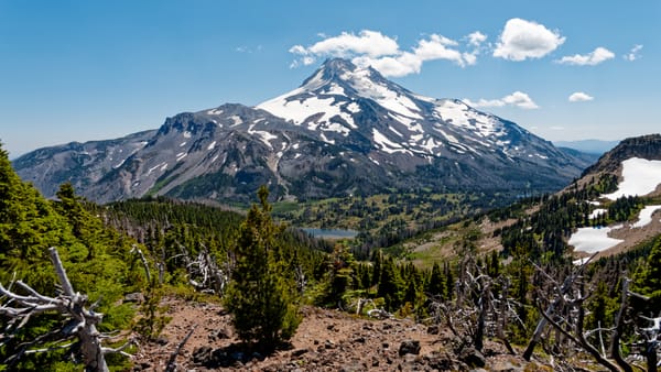
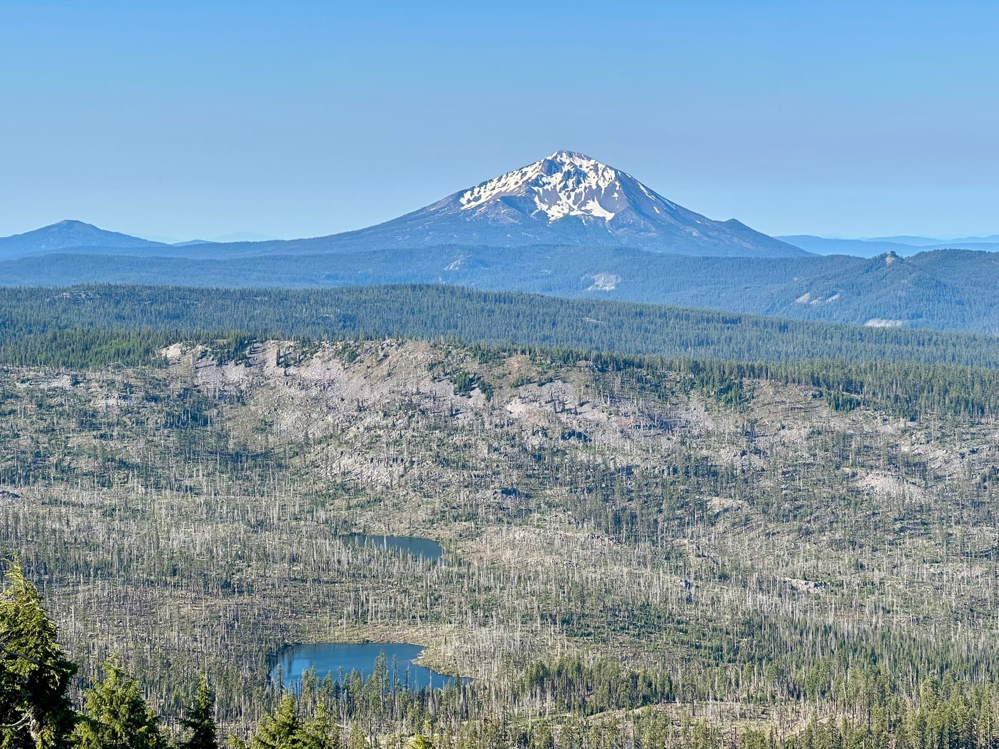
Eager to get back to hiking, we packed up and slipped out of Elk Lake early. It was shockingly cold for how warm it had been, and I regretted not getting my gloves out before packing them into the bottom of my pack. We had a quick little uphill that connected the trail to the lake, which helped warm things up a bit. Once back on trail, we then headed 1300ft up for our largest climb of the day. Anna and I had planned to stop and have breakfast at the top, but within seconds of sitting down, we were swarmed by mosquitoes. Around this time, Bush caught up, so we had breakfast on the move. The mosquitoes continued to be hell until a few miles after Sisters Mirror Lake, where we hit a large, open, and dry prairie. We also had incredible views of the nearby South Sister volcano. From here on, we wound our way through dense forests, pumice fields, and prairies along the west flank of the mountain for miles. Near the Linton Meadow Trail junction at mile 1971, we tried to stop for lunch, but again, the mosquitoes were horrible. We went maybe a quarter mile more up the trail and gave the Thermacell some time to heat up, and found a nice bug-free spot in the shade of a few trees. By this point, we had done nearly 20 miles, so we took a long break and tried to figure out our camping options for the night.
Refreshed and full of calories, we continued on and all walked at our own paces for a bit. I continued to listen to The Fellowship of the Ring until I arrived at Obsidian Falls at mile 1973.5, where I stopped to check out the falls, check out a few chunks of the namesake rock, and filter water for the remainder of the day. Nearly all of the volcanic rock we’ve seen has been pumice, and I have never seen obsidian where it naturally occurs, so it was cool to see it strewn about, glinting in the sun for miles. From that point on, we wound our way around the western flanks of Middle Sister and North Sister along with numerous buttes, cones, and craters. The landscape also became significantly more rocky until all of the plant life had been replaced with massive piles of red, grey, and black pumice. The landscape was truly amazing, and it felt like we had been transported into Mordor. Around mile 1976, we had a cool series of switchbacks that took us up piles of the stuff and into what appeared to be an old lahar flow area. While amazing to take in, the sharp, rounded rocks did a number on our feet and knees, and we were all feeling it. We ended up calling it a day, a bit off trail, near mile 1981, so that we could get out of the wind and avoid a no-camping area. We did a massive day considering the terrain, and we’ve set ourselves up nicely to get into town tomorrow. While we were setting up, the wind picked up and basically filled our tent with dust. Poor Bush had a tent pole snap! At least the mosquitoes have been kept at bay.