PCT Days 150 to 158 - Final Miles to the Border: Heatwaves, Highs, and a Quiet Ending on the PCT

Day 150
Due to the sun now rising well after 6am, we’ve moved our wakeup time back to 5:30am. It seems silly to unnecessarily hike in the dark (especially now that the temperature has cooled off a bit). Since we had knocked out most of the climb the day before, we only had 500ft to climb to the top of Grizzly Peak. From there, we had an immediate steep 1400ft drop over the course of 2.5 miles. We stopped at the base for a quick snack before powering up the next 1300ft climb… We were finally rewarded with a nice, long 5 mile 1400ft downhill. This constant up-and-down appears to be the overarching theme of the day. At the bottom of this one, we stopped for lunch around 11:40am and to enjoy some hot drinks and calories before the inevitable climb out. We had been expecting this section to largely be empty of section hikers and PCT hikers due to trail days going on, so we were a bit surprised to pass by about 10 people in the middle of the day.
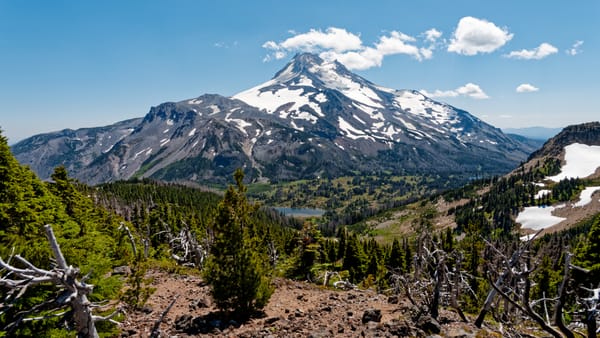
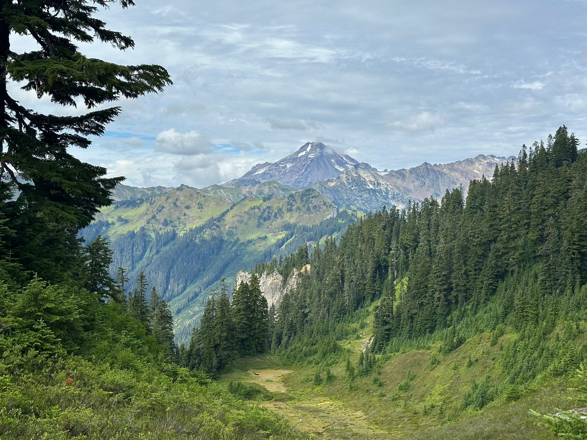
After lunch, we started up the next 1400ft climb. On this one, we finally saw some wildlife, including a grouse hen and her chicks, along with a red-tailed hawk giving off its signature screech. There were also the ever-present pikas and chipmunks darting about. At the top, the clouds began to rise and break up a bit, and we were rewarded with gorgeous views of Glacier Peak, now much closer than our last view of it before Stevens Pass. The rest of the day rolled by and was quite enjoyable due to the weather and scenery. At one point, we finally saw our first backcountry horseback riders of the whole trail! We continued on until 5:20pm when we stopped and set up camp at Reflection Pond near mile 2503.4. The mosquitoes were initially bad, which was unfortunate because we had to let the tent dry out from last night's condensation before we could set up inside. All in all, we did about 25 miles for the day, with about 6000ft of gain and 5400ft of loss. Despite all the climbing, we both felt great due to the nice trail conditions, broken-up climbs, and the blissfully cool weather. Hopefully the weather holds!
Day 151
Not long after I fell asleep last night, I woke up to the sound of rain on the tent and noticed that our surrounding area had been completely socked in. We had closed the doors, so we were dry, but it was still a surprise! We slept the rest of the night warm and cozy until we woke up in the morning to a condensation-laden tent. More people had rolled in late last night around us, so we did our best to pack up and depart quietly. It was still quite cold and damp when we left, so for the first time since the Sierra, I began the day in my fleece and gloves, despite our 1000ft climb! The climb was pleasant and gentle over the 3.5 miles, and as we ascended higher, the clouds began to break, casting a golden light all around us. Our shoes and socks were soaked through from the wet grass, but with the breeze and sun, they would dry in no time.
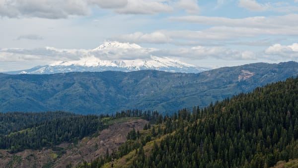
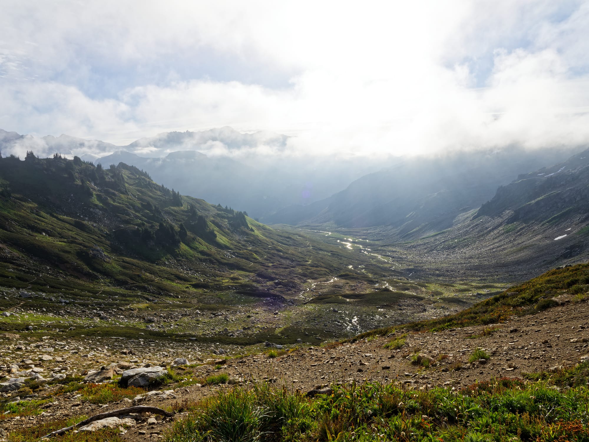
As we went over Red Pass at the top, we were rewarded with an incredible view of Glacier Peak shrouded in broken clouds, and the White Chuck River shimmering brilliantly below. The following downhill was long and steep, losing 3000ft over 6 miles. As we descended, the lower elevation combined with the rising sun to warm up the air around us. At the base of the valley, we passed a number of waterfalls and crossed numerous bridges spanning the White Chuck, which was now a raging torrent this far from its source high above at the pass.
The rest of the valley was a dense, lush, and muggy place that smelled wonderfully of earth and berries. Strangely, we saw very little in the way of wildlife, but we did pass numerous milky streams fed by the glaciers high above on Glacier Peak. Towards the end of the valley, we had to slow down considerably to pass through an exceptionally overgrown area, which then gave way to the roaring Kennedy Creek. Unfortunately, the bridge appeared to have long since been washed away, and the walls of the river valley appeared to have been heavily eroded by some major flood event. I wonder if a glacial dam high above had given way at some point? Still, the sheer walls were an incredible sight. Thankfully, it was fairly easy to ford the river, and due to its high silt content, I managed to find a wide, shallow, and slow section where I could cross barefoot.
On the other side, we greeted a few other hikers and then set off uphill on our next climb. We only went a little way up before we found a suitable spot for lunch and to dry our sopping wet tent. While we were enjoying our tea, a southbound hiker appeared and looked strangely familiar. It was Red Bull whom we had met way back in the Sierra! Apparently, he had injured his leg near South Lake Tahoe, took time away from the trail to heal, and was now hiking back to Tahoe from the northern terminus! We chatted for a bit while we packed up the tent, said our goodbyes, and then hit the climb. It was unfortunately deeply eroded and grueling as we gained about 1900ft in about 3 miles. We thought we would get a respite as the topography appeared to even out, but instead the trail was a roller coaster of steep climbs and descents for 2.5 miles before it then shot us up another 1000ft over 1.8 miles. The whole time, the sun cooked us on the exposed trail, and the humidity steamed us alive in our sun hoodies.
When we finally reached the top, we were rewarded with more amazing views of the North Cascades. Like the rest of this section, we then went straight downhill, passing the deep blue Mica Lake and countless large marmots before we stopped to call it a day at a tentsite at mile 2524.5. We banked 21 miles today, but did about 5000ft up and 5400ft down over rough, overgrown terrain. I believe tomorrow will be more of the same, but we should be able to knock out the big climb in the cool morning air.
Day 152
Another unexpectedly long day! We woke up at our normal time, but for the first time, I asked to sleep in for another half hour as I was dead tired. Once we packed the soggy tent up, we immediately went down 2000ft over 3.5 miles. The first half was just steep, but the second half was severely overgrown. It was also exceptionally muggy in the valley. At the bottom, we crossed the aptly named “Milk Creek” via the footbridge, and then dove into a steep, very overgrown climb. The first 2/3rds of the 2700ft climb over 4.5 miles was quite overgrown as well, and at one point, we came across a saw left by a trail maintainer with a note saying to utilize it if you had the time! If it had been a pair of loppers, I absolutely would have had at it! The climb seemed to take forever, and once the sun broke through the clouds, the valley became even more unbearably humid.
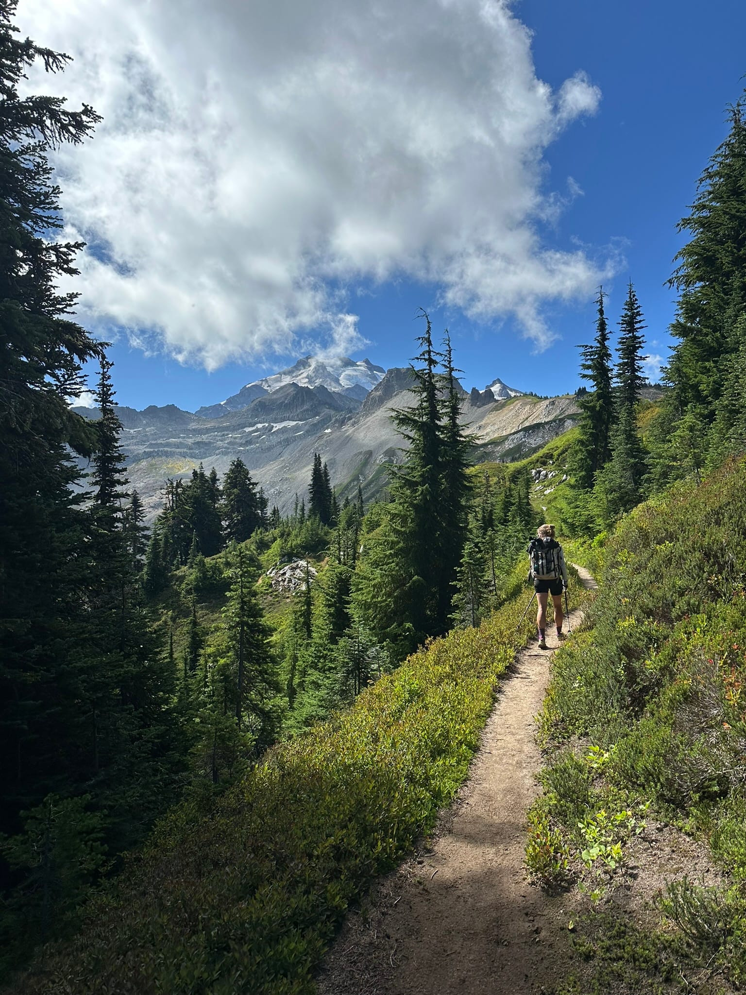
When we finally arrived at the top, I was soaked and exhausted. We had barely done 8 miles, and it was already past 11am. The next two miles almost made the climb worth it as we were rewarded with incredible views of Glacier Peak and the distant North Cascades, all covered in heavy glaciers and wreathed in clouds. We stopped briefly to filter water and watch marmots before we pushed on, eager to make up mileage.
We stopped at the Dolly Vista Trail Camp at mile 2534.7 to have lunch, dry out the tent, and enjoy the view before we headed down. Refueled and slightly refreshed, we headed down 3700ft over 9 miles towards the Suiattle River. Once again, the majority of the downhill was quite steep and full of blowdowns. As we neared the bottom, the trees became much larger (think coastal redwoods and hemlocks) and the blowdowns took more and more time to navigate. Once we passed Vista Creek at mile 2540.7, the blowdowns ended, and we could see signs of recent trail maintenance! Shout out to the BCCC crew for the amazing work!
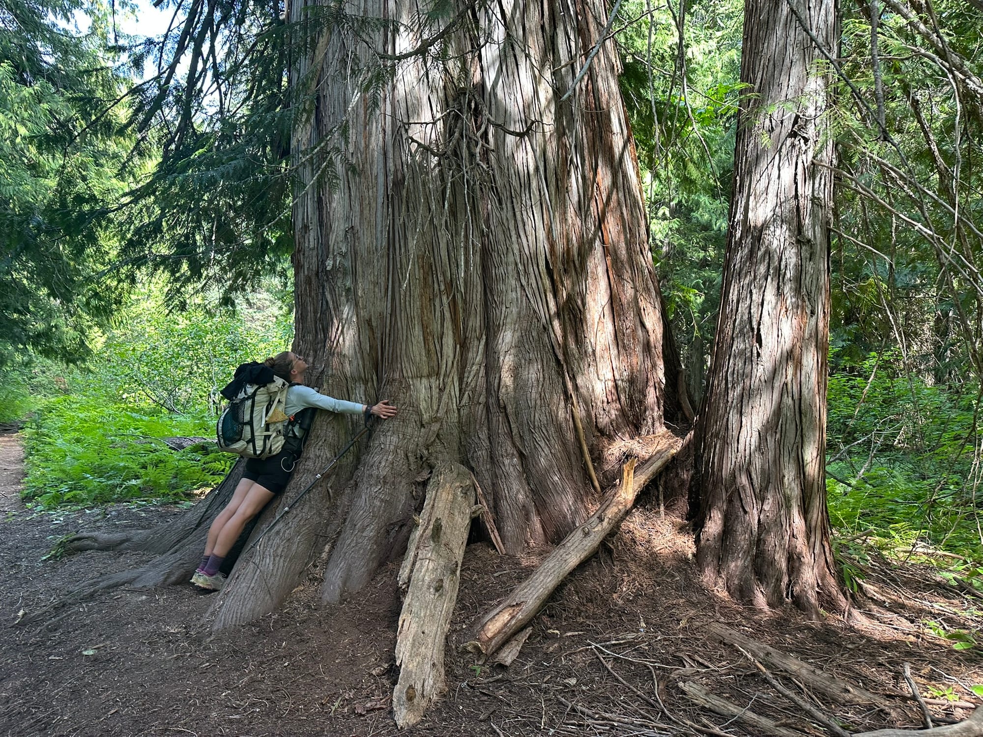
The next several miles were some of my favorite of the whole trail, as we passed through an incredible old-growth forest filled with giant hemlocks, coastal redwoods, and a variety of fungi. We then crossed the raging milky Suiattle River on the new footbridge and hiked a few more miles before setting up camp near mile 2546. We managed 21.5 trail miles for the day, but my watch is saying we did more like 25. Not to mention the grueling bushwhacking, 6000ft of loss, and 4000ft of gain. Needless to say, we were both pretty beat when we rolled into camp around 6:30pm. I know we’ll have a massive climb again tomorrow morning, but I’m hopeful the cooler temperatures will continue to hold and that the rest of the trail will be more friendly.
Day 153
Amazingly, despite our late evening, I heard people continue to hike past us well into the night, as I had trouble sleeping. When I woke up at 5:30am, I was quite tired and it was still dark in the valley, so I snoozed for another 20 minutes. What finally roused me was a strange stomach ache… I ate a few crackers to try and soothe it, and we hit the trail. We had a nice, smooth .5 mile walk before we hit the Image Lake Trail junction. Since we wanted to check out the top, we hopped on it and immediately started the steep climb up. Over the next 4.75 miles, we gained 3700ft over a sweaty couple of hours. Halfway up, we met two wonderful women who are the ONLY NFS TRAIL CREW for this ENTIRE FOREST… I thanked them profusely for the backbreaking work they’ve done to improve this section, and then continued up.
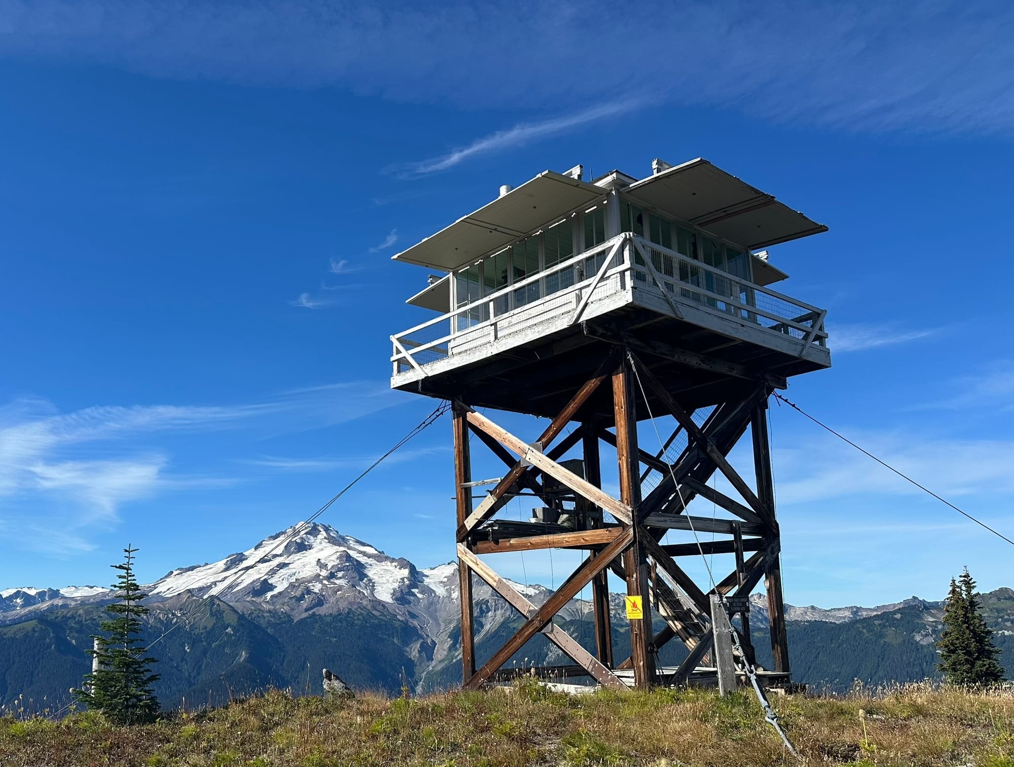
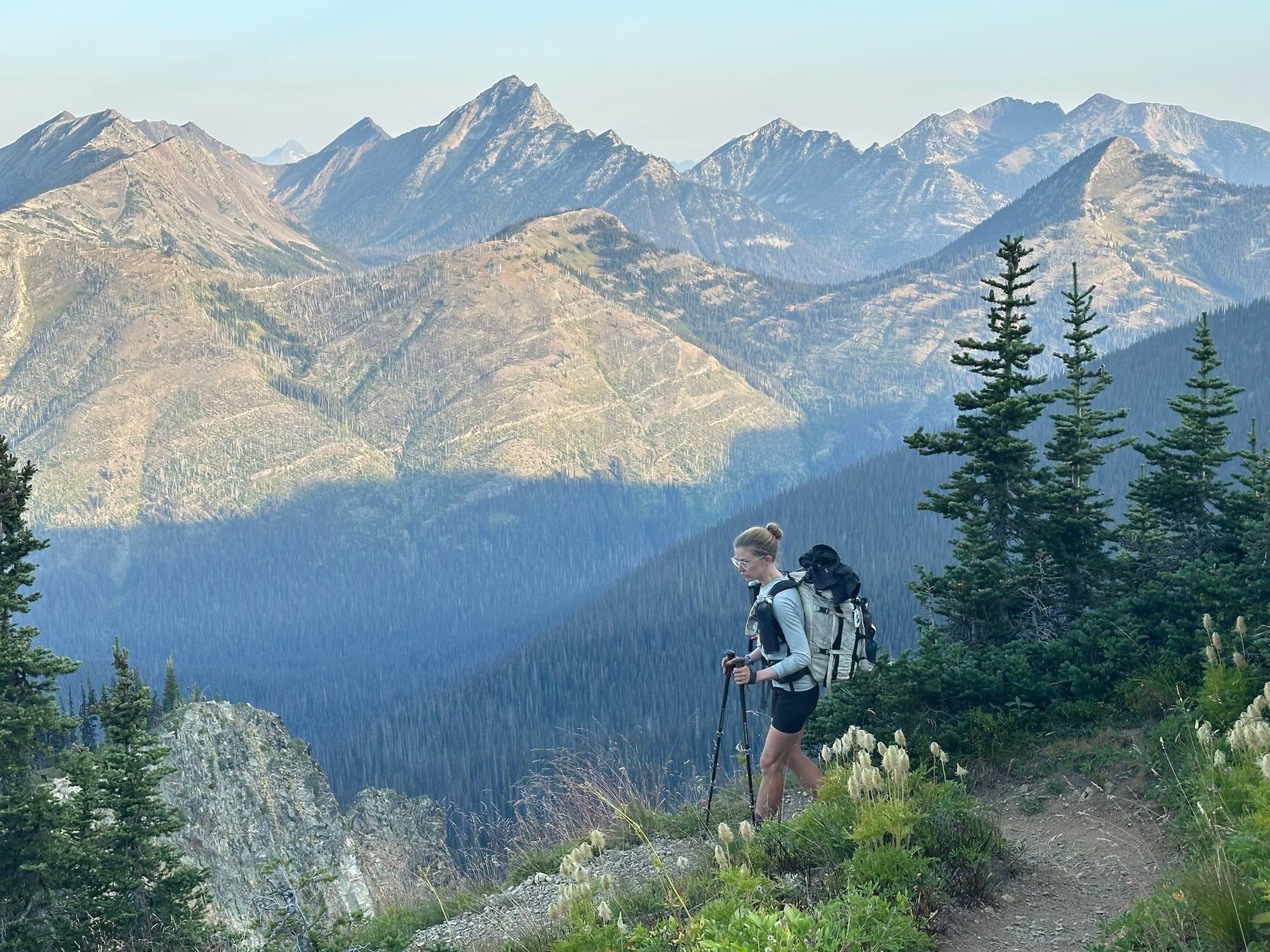
Not long after Anna saw a large black bear ahead of her getting into the huckleberries, but she had ambled off into the woods before I arrived. We continued on rather uneventfully until we finally crested the ridge. From there, we headed west briefly to check out the Miners Ridge Fire Watch Tower and to soak in an amazing view of Glacier Peak and the surrounding North Cascades. Unfortunately, the caretaker was not home, so we couldn’t get a tour, but we still hung out to have a snack. My gut was still giving me trouble, so after our break, we continued slowly east towards Image Lake. The trail was quite exposed, but it was gorgeous. It’s honestly a shame the PCT doesn’t go up here. We saw several massive old marmots in the berry patches and a couple of locals out for a multi-day hike. After Image Lake, we descended to the Miners Ridge Trail and followed it until it rejoined the PCT at mile 2554.2. Along the way, we passed several old tin-roofed shacks built into the cliffside, which I assume were remnants of the aforementioned miners.
Back on trail, we were plunged back into the shade of the trees, and we had a quick 500ft climb to the top of Suiattle Pass. I was really dragging due to my stomach, and we were a bit behind due to the alternate trail, so we hustled down the other side. Not far down, I called a halt at a campsite at 2555.6 to make use of the open-air privy and to try and get a few bites of food down to replace what I had lost. I finally caved and took some Imodium as well since I was quickly becoming dehydrated. After a break, we continued on, passing some incredible views of the sheer mountain cliffs surrounding us. At one point, we saw a familiar SOBO pass us and called out to him. It was Cheeto whom we had met way down south in Tehachapi. He had flipped up to the northern terminus and was now hiking south.
From there, we pushed forward until I had to stop once again at a privy near mile 2558.7. After this last stop, the Imodium seemed to finally kick in, and I was able to hike normally. We then carefully finished the 3200ft descent down to our target tentsite at Cedar Camp near mile 2565.5, a bit after 6pm. On the way down, we saw multiple grouse hens, a snake neither of us recognized, some spotted frogs, and an incredible variety of fungi. Once we were set up, we went and had dinner with a couple we had been leapfrogging with all day. They were Emma and Ben, whom we had briefly chatted with way back at the White Water Preserve! We had a really lovely long dinner and evening together before heading to bed. Hopefully, we’ll all spend more time together in Stehekin tomorrow!
Day 154
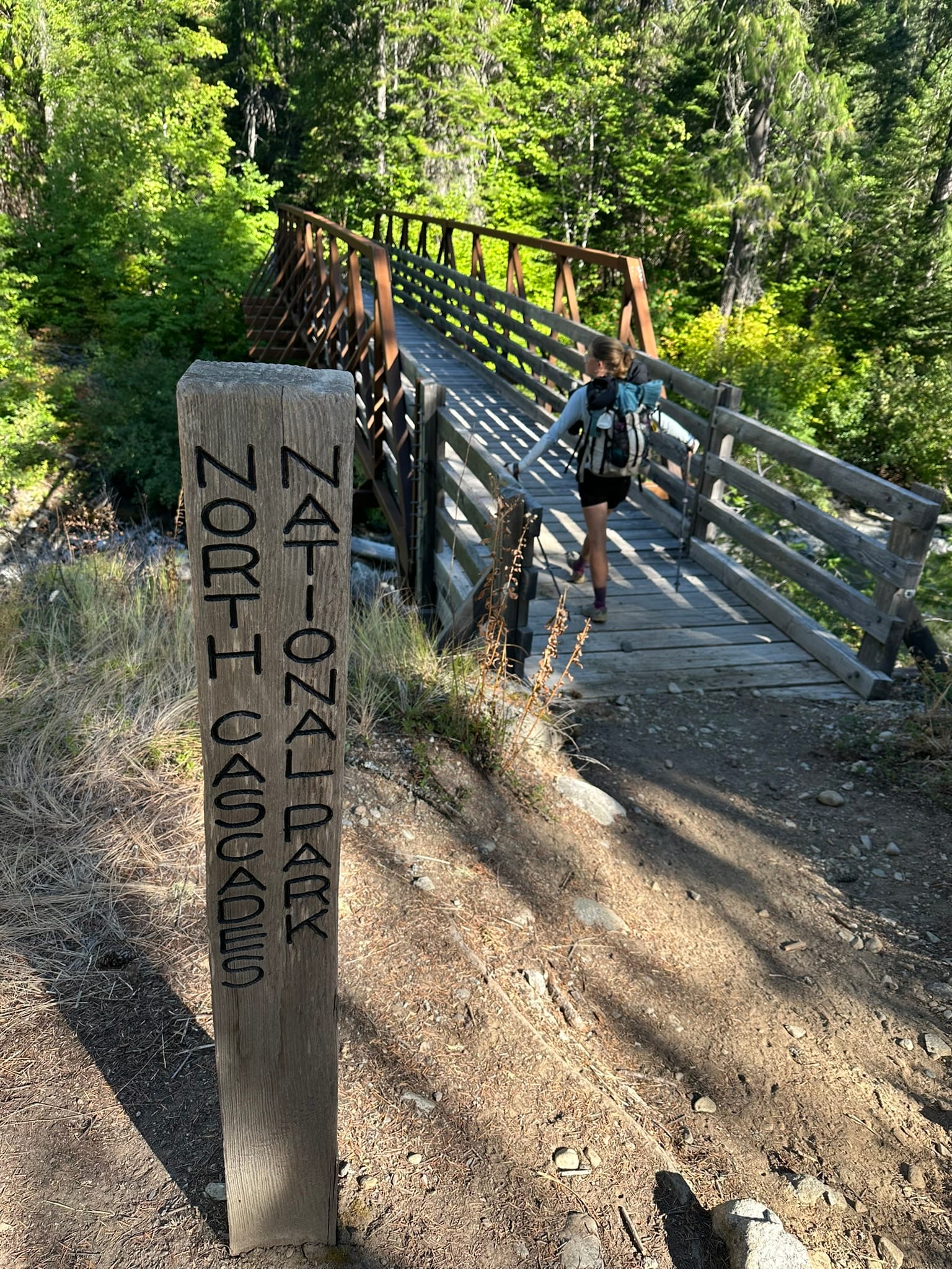
I was once again dead tired from my gut issues yesterday, so we slept in, figuring that we wouldn’t make the 9am shuttle without headlamp hiking. The section of trail from our tentsite to the road was incredibly well-maintained and cushy due to the pineduff. As a result, we made excellent time, knocking out the 10 miles in less than 3 hours. Unfortunately, this meant that we arrived at High Bridge Camp at 9:15am, just 15 minutes after the morning bus had come by. Woops. As we crossed the bridge, we officially entered North Cascades National Park, the last national park of the trail! When we walked up to the camp area, we found Bedhead demolishing a cinnamon roll that he had grabbed from the bakery on the way out. He told us that the bus had even been late, so we literally just missed it! We chatted with him for a bit before he hiked on, and then we chatted with the caretaker for a few hours as we waited for the 12:30 bus. While we waited, a few other hikers rolled in that we didn’t know, and then Ben and Emma arrived, so we hung out with them for a while. Since the road only goes into Stehekin, there were no cars to even attempt to hitch with, so we just relaxed for the duration.
Eventually, the bus arrived, dropped people off, and loaded us up. Once on board, Rocky, the driver, quickly started rambling off random and interesting facts about Stehekin’s history. Despite most of his information being seemingly random and disconnected, it was still fascinating to learn about an area I knew nothing of, and it’s impressive that he did this on every bus ride! Along the way into town, he stopped in at the bakery where everyone ate their fill. I was feeling a bit overwhelmed by all of the summer tourists, so I mistakenly passed on the baked goods and opted for a sandwich and an Arnold Palmer instead. Loading back on the bus, Rocky, with a chuckle, informed me that he used to enjoy Arnold Palmers with ice and vodka until his wife told him to stop. Back on board, we passed the 312-foot-tall Rainbow Falls, the old schoolhouse, the apple orchard, and then we came into view of Chelan Lake. The views of the mountains surrounding the lake were stunning, and with the temperature quickly climbing, all I could think about was how ready I was to jump into the water.
Once we arrived in the main part of town, Anna and I grabbed our resupply boxes and then wandered around on the annoying, steep hill to find somewhere to squeeze our Durston in. The free camping area wasn’t very large, and due to the poor behavior of others and the overall rough terrain, it was difficult to find a suitable spot to pitch the tent. After a lot of sweating, we were finally able to get an alright pitch on the tent, so we headed back down to town to knock out our chores. There was a large line forming for the laundry, so we opted to combine our stuff with another hiker. There was also a long line for the shower, so I threw all of my clothes, except for my boxers, into the wash and jumped into the lake while I waited. When I saw one of the hikers ahead of us in line walk by, I climbed out to investigate our progress. I was also done swimming because two other hikers had decided it was a good idea to skinny dip in the middle of town and make a scene with the locals. The laundry was done, and frustratingly, the other hiker had swapped out his worn-out socks for my new pair that I slept in… The shower was open now, though, so I grabbed a nice cold rinse and then planned the rest of the evening out with Anna.
By now, it was finally cooling off, so I didn’t immediately sweat through my clothes. We went and plugged our battery banks in, and then joined Gadget for dinner at the only restaurant. The air was becoming a bit smoky, but otherwise the evening was absolutely perfect along the shores of the lake. We hung out for hours before the sun started to set, and then Anna and Gadget headed up the hill to the tents. I went to check on our charging batteries and discovered that not only had someone unplugged them before they were even half full, but they had also dropped them, causing chips and cracks in their casings! Man, people suck! Since pretty much everyone had gone to bed by this point, I just plugged everything back in and stayed up late reading and looking at the stars. I had wanted to go to bed early, but alas. Overall, I’ve really enjoyed Stehekin, but the actions of a few of the other hikers here have really soured my overall experience.
Day 155
Anna and I both unfortunately slept poorly due to our sloped tent site, rowdy deer, and noisy neighbors in the group site. It was also toasty up on the hill, so I packed up early and went down to the visitor center to check the weather and enjoy some of the breeze of the lake. When I was finally able to get the wifi to work, I was appalled to see that a heat advisory had been issued and that temperatures in the high 90s to low 100s were forecasted for pretty much the rest of the trail. A red flag warning was also issued due to the hot, dry wind, and a chance for scattered thunderstorms later in the week. Not wanting to hike in the heat of the day, Anna and I broke down the tent and hopped on the 8am bus back to the trail.
We both loved Stehekin, but we were disappointed in the bad behavior of other thru-hikers souring our experience. On the bus, we chatted with Gadget, who was only going in to grab breakfast at the bakery. He had decided to call it there for his LASH, so he planned to grab a ferry back to Chelan later that day. At the bakery, we said our goodbyes, grabbed a few quick snacks, and hopped back on the bus to the trailhead. It was already pretty warm at 9am when we arrived at High Bridge. The other hikers shot off immediately while we enjoyed our pastries and drinks. Fueled up, we opted to take the Stehekin River Road for a few miles to stay next to the gorgeous river. Eventually, it ran out, though, so we hopped on trail and hiked a few miles before stopping at Bridge Creek Campground. There we checked out the shelter, and then took a siesta to avoid the heat of the day. By this point, the air was sweltering. We hung out until 2pm, and then forced ourselves to hike on.
As we climbed higher and further north along the Stehekin River and then the Bridge Creek, the land became considerably drier with the occasional small burn scar. What few berries we passed were shriveled and hard, and the leaves were already turning. We climbed up and up, cooking in the direct sunlight with very little reprieve. Near Berry Creek, we suddenly came upon Luke, a backcountry ranger for North Cascades National Park, who just happened to be the ONLY backcountry ranger we had met all trail. This, despite passing through 7 national parks and countless national forests and wilderness areas. He was incredibly kind to us, checked our permits, and made sure we were alright in the heat and aware that the heat was only getting worse. He also warned us that practically the whole North Cascades were currently a tinder box and that he fully expected wildfires to pop up with the storms. After we thanked him, some other nobos from town trucked past us, and we crawled the last few miles to our destination, Six Mile Campsite at mile 2586.3.
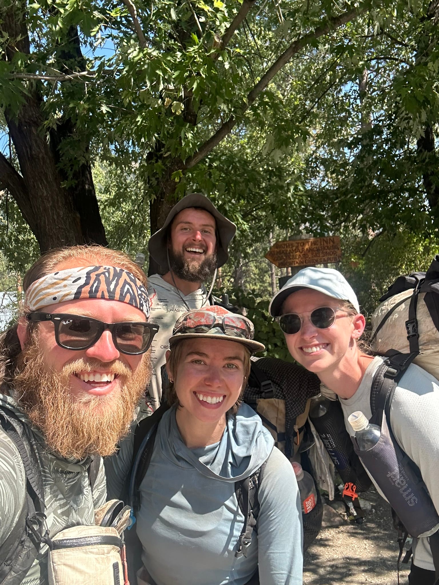
We were both beat, had headaches, and I was feeling faint. After I got some water in me that wasn’t hot, I popped the tent up, and then jumped into the icy Bridge Creek to cool off. Anna and I looked at the map and pulled the forecast on the Garmin and decided to bail out to Mazama from Highway 20. We’re here for fun, and there is nothing fun about hiking in extreme heat. We’ll probably hitch from there to Harts Pass to run up and tag the border before the storms hit. It stinks to cut mileage in an area we love so much, but we have no desire to hike in the heat, we’re worried that more fire closures may happen, and we don’t have the option to wait out the weather. On a happier note, Hedgehog, Ben, and Emma all ended up joining us at our beautiful little campground tucked into the woods!
Day 156
We started the day off as usual and hit the trail around 6am to try and beat the heat. The first hour or two were pretty nice as we climbed our way up, but by 8:30am it was already getting pretty hot in the shade. When we made it to the Bridge Creek Trailhead just after 9am, we stopped off to have a snack with Emma and Ben, and we were all already drenched in sweat. There were tons of cars on Highway 20, so we went ahead and hitched up to Mazama, skipping 30-ish miles of trail that we’ll come back and hike and do trail magic at next year.
When we arrived at Mazama, Anna grabbed a pastry while I waited out my carsickness. As we were sitting there, Jacqueline and Walker strolled up from a hitch and had just finished! It was then that we learned that Coffee had gotten off in Snoqualmie Pass due to a bad injury. She was so close! We hung out with them for a while to wait out the heat (it hit 101 degrees!), and at one point Bedhead and his family rolled up as well. We also received a text from The Jeffers that he had already finished as well! Around 2pm, we said goodbye to Jacqueline and Walker, and then went to try and hitch up to Harts Pass. By this time, it was still brutally hot, but with the thinning traffic, we were worried we wouldn’t get a ride if we waited any longer. While we stood there, two Canadians, Renee and Shane, joined us to hitch, and then Bedhead, his dad Mountaingoat, and his sister Kira all came to hitch as well. It was then that Jeff, a local whom the Canadians had talked to earlier, offered to cram us all into his large truck and drive us up the pass!
The first few miles of the drive were fine as the road was paved, although it was hot because the truck’s air conditioning seemed to be going out. The 3 in the bed of the truck were absolutely roasting, though. Things got worse when the road turned to gravel and heavy dust. I started feeling a bit motion sick up front, as did a few others. The guys in the bed were really feeling it, and a few miles in Mountaingoat asked us to stop as he seemed to be on the verge of heatstroke. We pulled over, and everyone got out to breathe some clear air, and Shane swapped places with Mountaingoat. Once everyone had recovered a bit, we hopped back in and slowly made our way up the last few miles. Finally at the pass, we thanked Jeff profusely and then everyone promptly sat down in the shade and chugged water while we recovered. It had been 101 down in Mazama, so it being 88 at the pass felt wonderful by comparison.
Around 4pm, everyone started to individually hit the trail. Anna was still feeling a bit off, and the 800ft climb out was fully exposed, so we took it nice and easy. Despite the heavy haze, we had amazing views of a fire tower and the surrounding jagged peaks of the North Cascades. It was also shockingly dry and barren compared to the rest of Western Washington. Once on top, we had a bit more shade, and the temperature seemed to drop off along with the humidity. We put on our respective audiobooks and cranked out a few miles. Around mile 2631, we stopped to filter water for the evening, and we chatted up Bedhead about his post-trail plans. From there, we pushed on, passing our friends from the car ride, and getting a few more miles before sundown. We stopped at a little single tent site around 2633.3 near Jim Pass and called it a day.
It’s amazing how many people are in this section right now, so we were glad to have secured a spot. After a quick dinner, we tucked in and promptly got ready for bed so that we could beat the heat again tomorrow. It’s a shame the end of the trail is ending up so regimented due to the extreme heat, but we’re hopeful we finish before the storms roll in!
Day 157
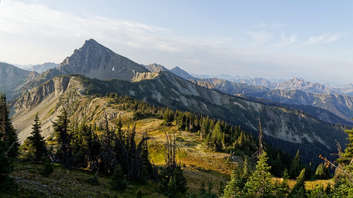
Eager to hit the terminus today, we woke up around 5am, packed up, and hit the trail just as the mountains in the distance began to faintly glow. It was blissfully cool and dry for once, so we quickly put down miles. Over the first 6 miles, we lost about 1700ft of elevation and saw no one. After Holman Pass, we climbed up about 3000ft to Rock Pass, went down and up through an exposed furnace of a section, and then crested over Woody Pass, the final climb of the PCT. Along the way, we passed several people who had finished the day before, and we all congratulated each other.
By the time we reached Woody Pass, we had hiked about 15 miles, and it was already quite hot and sunny. Strangely, we passed another person dumping out just off the side of the trail… I wonder what the heck has gotten into people? Once we crested the pass, we headed down to Hopkins Lake for lunch around 1pm, and we set up our tent so that we could tag the border more quickly. While we were having lunch, we ran into AC and his gang, whom we had not seen since Trout Lake! They had just finished and were hanging out on the banks of the lake. Mountain Goat and Kira also arrived, dropped their stuff, and immediately headed downhill to the border.
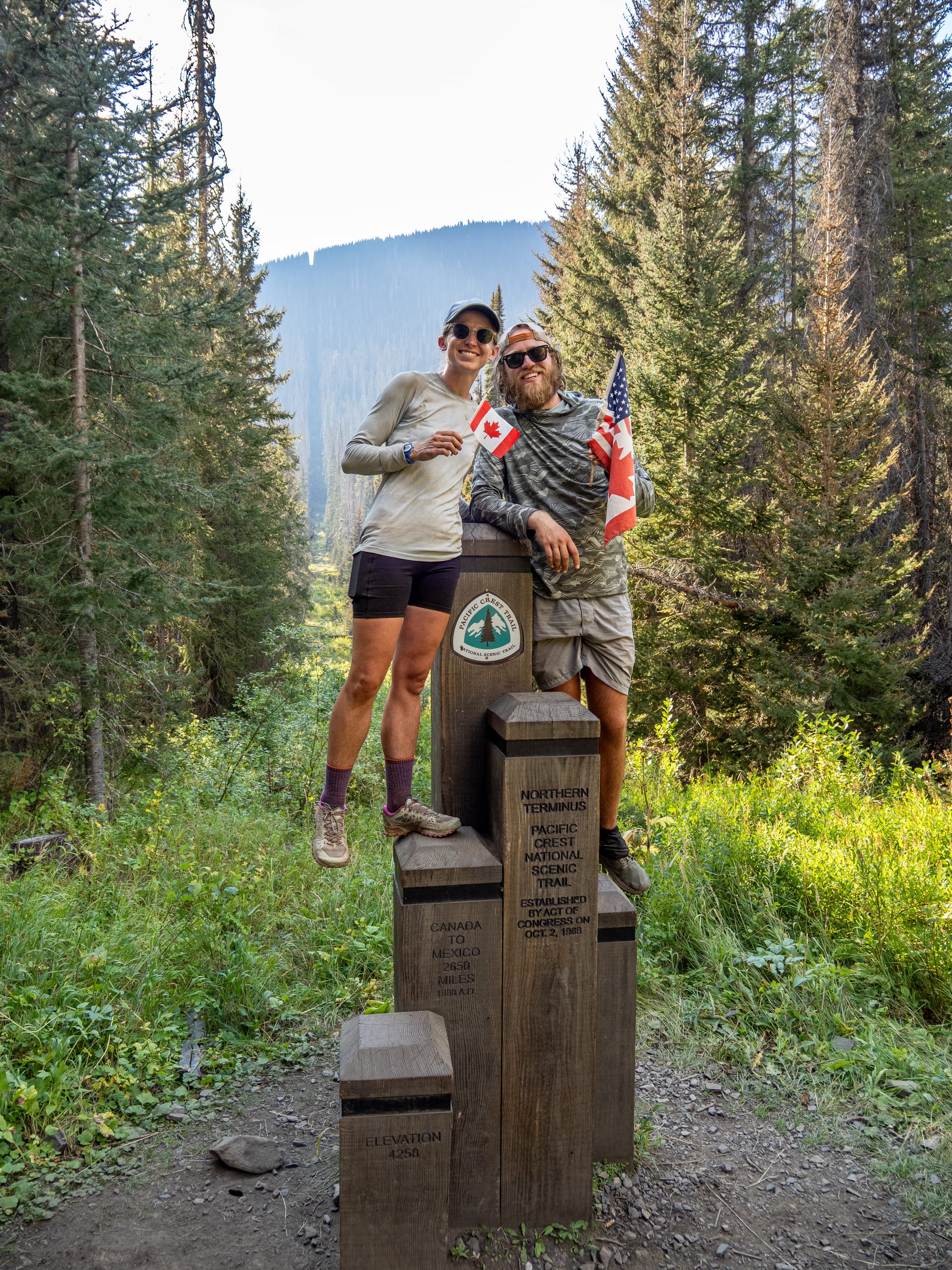
Around 1:30pm, we wrapped up lunch and then began hoofing it, the 6.5 miles and 2000ft down to the terminus. This section of the trail was blissfully cool and shady, so with our light packs, it felt like we were flying downhill. Right around 4pm we arrived to find Mountain Goat and Kira at the terminus waiting for Bedhead to arrive. We all chatted for a bit before Anna and I filled out the trail log, popped our mini bottle of champagne, and took a few pictures. Not long after we finished, Bedhead and a few others rolled in, so we all chatted and snacked together for a bit. I’ll be honest, it all felt a bit anticlimactic, especially compared to Katahdin on the AT. I think it was further exacerbated by the knowledge that we couldn’t go into Canada and that we still needed to hike 30 hot and sweaty miles back to Harts Pass. I took a few pictures of our friends and then Anna and I turned and headed back up the hill.
Along the way, we passed a few deer, and a large thunderstorm rolled over and boomed off the mountains. A very fitting finale. We made it back up to Hopkins Lake around 7:30pm to a soggy tent from the storm. I helped Anna get it dried off and set up before going for a quick swim to cool down and rinse the grime off. After my swim, I sat there for a while and watched the sun set slowly over the mountains while large blue dragonflies skimmed by. I was glad to be done, but I definitely have some conflicting thoughts on this thru-hike. Once I dried off, Anna and I had dinner and then passed out early from our extremely hot day of 30 miles, and about 6000ft of climbing and 6000ft of descending. Needless to say, I’m proud of our accomplishment!
Day 158
We were shot after yesterday, so we opted to sleep in a bit and try to recover. We still ended up hitting the trail before 7am, but it was already warming up. The climb back up the viewpoint went by pretty smoothly, but I was really dragging. At some point, Bedhead passed us by and quickly disappeared into the distance. Near the top, we stopped to have breakfast, and the Canadians caught up with us and had breakfast as well. Once we were over the top, we started passing more people we knew, and everyone was cheering each other on. We made it over Woody Pass a little bit past 10am, so it was already a furnace in the exposed valley between there and Rock Pass. This was easily the most miserable section of these last few miles. The trail essentially sends you down 1500ft over 3 miles and then straight back up 1000ft over 1.5 miles. The whole time you’re baking in the sun and walking on loose, slippery rock.
Once at the top of Rock Pass, we passed by Emma and Ben, who were headed to the terminus, and we stopped to chat for a bit and to congratulate one another. I’m so glad we got to see them again! Once we made it over Rock Pass, I mentally checked out since I remembered that the rest of the section was pretty cushy. We continued on, going up and down the ridges and passes we had hiked the day before, but it felt considerably hotter than yesterday, so we kept having to stop for water. We ended up leapfrogging or hiking with the Canadians all day, and had lunch with them by a stream. The last few miles ended up being a slog, and we were worried about potential weather once it started to cloud up.
Thankfully, we all made it back to the Slate Pass trailhead around 4:30pm without any major storms. A nice man there gave us beers and sodas, and then offered to take us to the parking area at the top of Harts Pass, effectively cutting off a steep downhill for us. Once we arrived there, Anna and I started trying to hitch at the parking area, while the Canadians went down the road to try and hitch from the campground. Our hopes were pretty low for a hitch this late in the day until a VW bug and a Ford Maverick drove by. Anna and I were throwing out our thumbs from chairs someone had left in the parking area, and both of the drivers gave us a thumbs up back and drove off. They then stopped down the road, and the Canadians called to us. They had taken more initiative and actually flagged down both cars and directly asked for rides!
Both of the guys driving the cars were buddies who had just come back from a gold prospecting trip, and they were more than happy to take us. The truck only sat three people, so I opted to ride in the bug with its owner, Dave. Since the road up to Harts Pass is long and bombed out, we spent a lot of time together. He talked about how he got into prospecting, how he learned to fly powered paragliders just to check out parcels of land he was interested in purchasing, and all other sorts of interesting stuff. Needless to say, I was incredibly tired, so it took a lot of effort to stay awake. Once we pulled into Mazama, we all stopped to figure out where to go next. The two guys were headed east, then south, and they offered to drop us off in Winthrop along the way. We cruised on, chatting about a myriad of topics that I could hardly keep up with. Once in Winthrop, they dropped us off at the Inn, said goodbye, and went on their way. I’m glad we got to get one more interesting hitch in to close off the day. Since it was already 7:30pm and everything was closing, we threw our things in the room and headed out for pizza. There we found the two prospectors already halfway through their pie! We all hung out a little while longer before turning in for the night, completely exhausted but happy to have wrapped up the trail! I’m also incredibly thankful that we were able to close this adventure off with others!