PCT Days 20 to 29 - Finally Getting My Trail Legs

Day 20
Zero day! We slept in nice and late until 6:30am in our cushy king bed, and then I snuck out to start on breakfast. Anna woke up shortly after to make coffee and then took over on watching the biscuits as I ran to the store to grab more milk for the gravy. Crisis averted, we had a heaping pile of biscuits and sausage gravy ready by the time Sour Patch woke up!
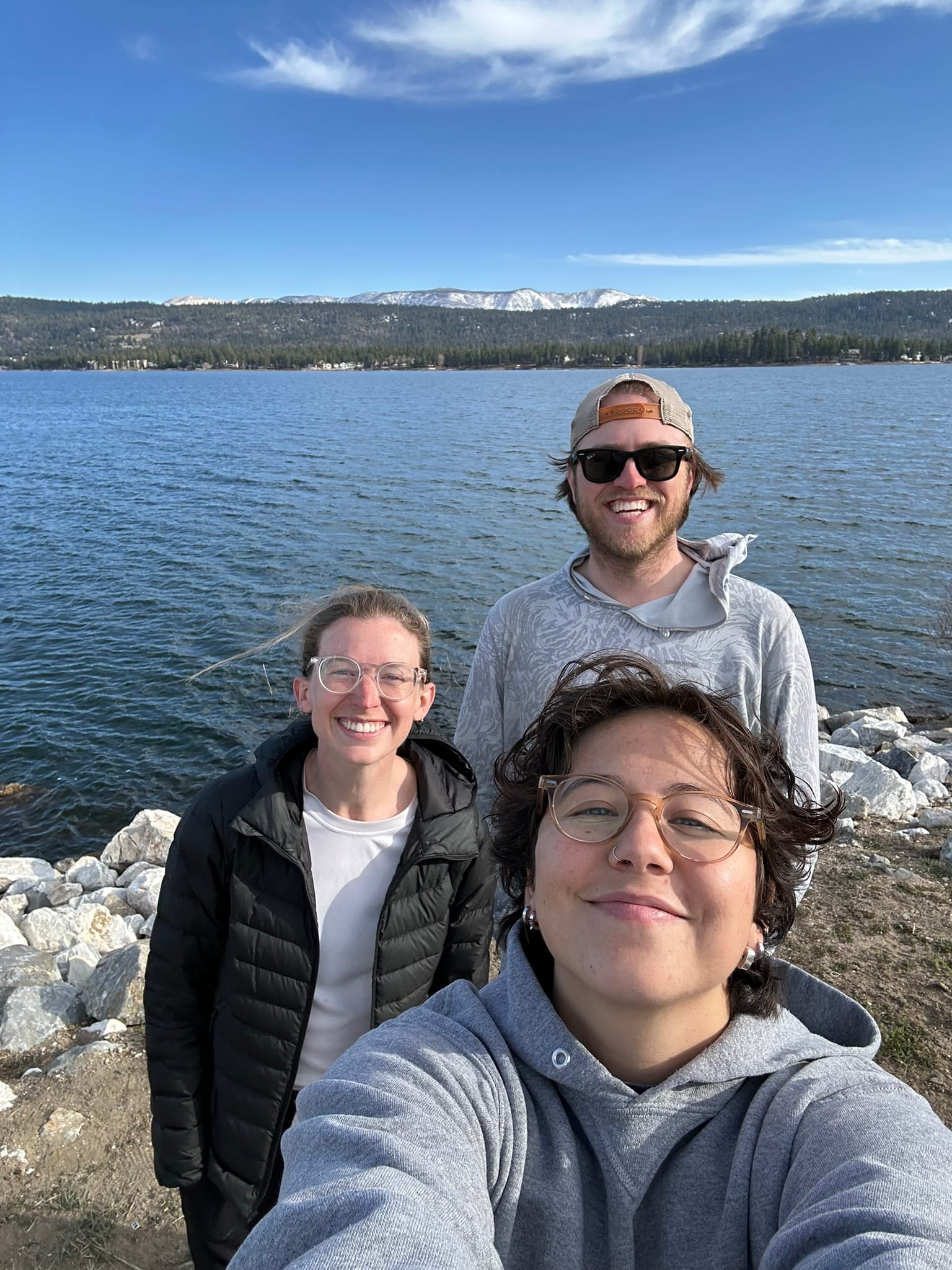
After breakfast, we caught up on some camp chores and then finally got to watch The White Lotus season finale! After we finished our show, Sour Patch drove us around Big Bear Lake and served as our tour guide, stopping off at the solar observatory and the marina. After our drive, we stopped in the grocery store to grab some steaks and potatoes for dinner. I then made steak frites for everyone and baked a batch of chocolate chip cookies for dessert. We then spent the evening just chatting and relaxing until hiker midnight called Anna and me to bed. It has truly been a wonderful zero, and I am so thankful to Sour Patch for hosting us!
Day 21
Anna and I woke up before our alarm at 6:30am and started quietly finishing up some last minute chores that we had neglected. Thankfully, none of them took too long so we were able to cook a big breakfast of leftovers once SP woke up. I made steak and eggs with leftovers for Anna and SP, and then I fried up some eggs for myself to have with the leftover biscuits and gravy. We then cleaned and tidied up before loading up and heading back to trail.
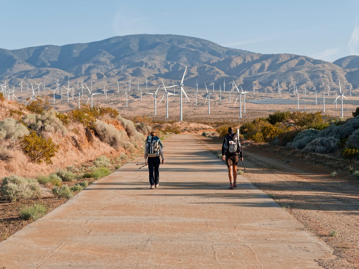
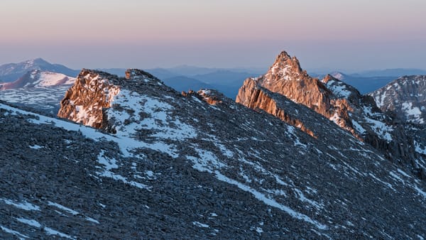
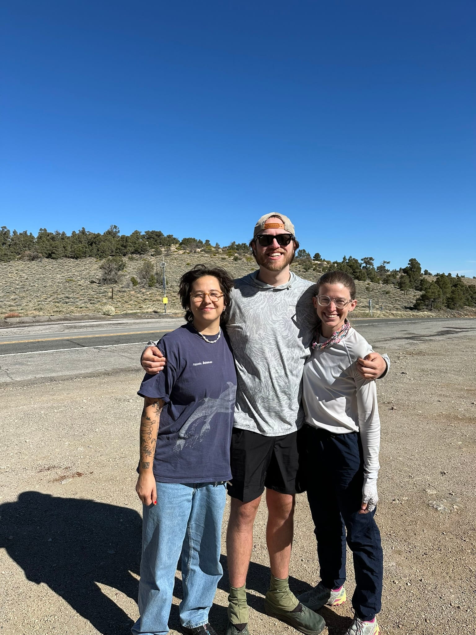
Once back at the trailhead, we saw Dynamite and some familiar faces getting dropped off as well. SP handed out the leftover cookies, we took a group picture together, and then they grabbed a hiker who had just arrived and left to drive them to town. Anna and I then hit the trail around 9:45am with no real goals for the day and just sort of cruised over the friendly landscape. The desert alpine environment was nice and shaded in most areas, and it provided incredible views overlooking Big Bear Lake. A little after noon, we stopped at Caribou Creek for water and to take a break, and to chat with some hikers we had just met there. Happy with our pace and the terrain, we then continued on hiking until a bit later than usual and stopped at Little Bear Springs Camp (mile 285.6) for the night, having done 19.4mi for the day. Along the way, we really enjoyed watching the landscape change from the dense forest to vibrant new growth in the burn area. So far, this has easily been the most enjoyable section to hike!
Day 22
Despite our comfortable spot, Anna and I both woke up pretty sleepy, so we didn’t end up getting started until a bit after 6am. Once we started moving, we were surprised to see that, apparently, a bunch of other people had rolled in after we went to sleep and set up tents! It was also incredibly cold, so we started in our layers. Right off from the start, we noticed that the trail was still quite overgrown and a bit challenging to follow in a few spots. We only saw a few people pass us, one of whom was Masochist, but otherwise the trail was pretty empty despite it being a popular day hike area. At one point, when Anna was leading, she slammed on the brakes due to the telltale sound of a rattlesnake! It appeared to be hiding in the bushes off the side, but we couldn’t get a good view of it. The section of trail was pretty hemmed in, so there was no going around. In an attempt to get it to move, I grabbed a long branch and started rustling all of the shrubs. There was still no noise, so I peppered the shrub with sand and a bit of gravel in an attempt to scare it off. Still no rattle. So I went first, slowly shaking each shrub as I went with my poles, nothing. Thinking we were good, Anna then followed suit, and when she was nearly towards the end of the hedge, we heard the rattle once again! Thankfully, we were past, so we just walked on, albeit a bit more vigilant.
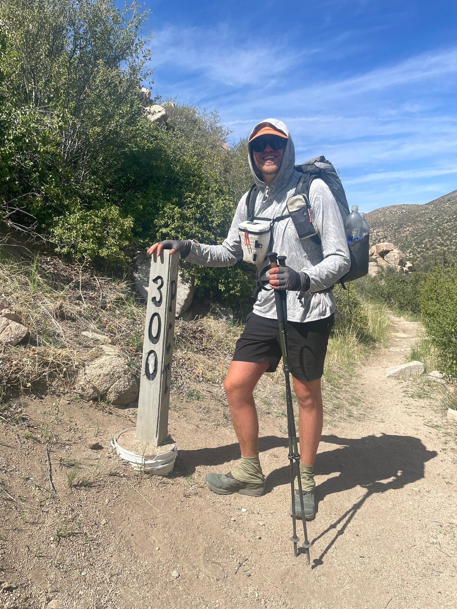
From there, we motored on and stopped at Deep Creek Bridge to have lunch and a long break along the creek’s sandy bank. We had already done 13ish miles for the day, so we were a bit gassed from all of the bushwhacking. Once we were feeling a bit rejuvenated, we continued on, now following Deep Creek from the cliffs above. This section was quite pretty, but the trail was fairly eroded in a few areas due to what looked like illegal dirt bike usage. Along the way, we encountered another obstinate rattlesnake, a gopher snake, and others. Worn out and not wanting to deal with the crowds near the hot springs, we called it a day at mile 305.9 right next to a gorgeous high-flowing stream. All in all, we saw 6 snakes, traveled 20.4mi of overgrown trail, and dropped down over 4000ft in elevation. Needless to say, I was very happy to be soaking my feet in the ice cold stream!
Day 23
The back to back 20s, along with the eroded trail yesterday, left us pretty drained, so we ended up sleeping in a bit past 6am. Once we started moving, though, this section proved to be very friendly, and we quickly started to make miles. Pretty early on, we passed by the hot springs, which were bustling with thru-hikers and weekend hikers alike. Sadly, the area was also quite polluted with discarded coolers, cans, graffiti, etc. Due to the water reports being pretty gnarly, we skipped the springs and hiked on by. We then stopped at the bridge at mile 310 for breakfast, where we chatted with Twig about some dirt bikers we had seen tearing up the PCT, and then we met and visited with Crib. Of note, while we were chatting with Crib, a naked guy walked by. Apparently, he had hiked the 5 or so miles in the nude!
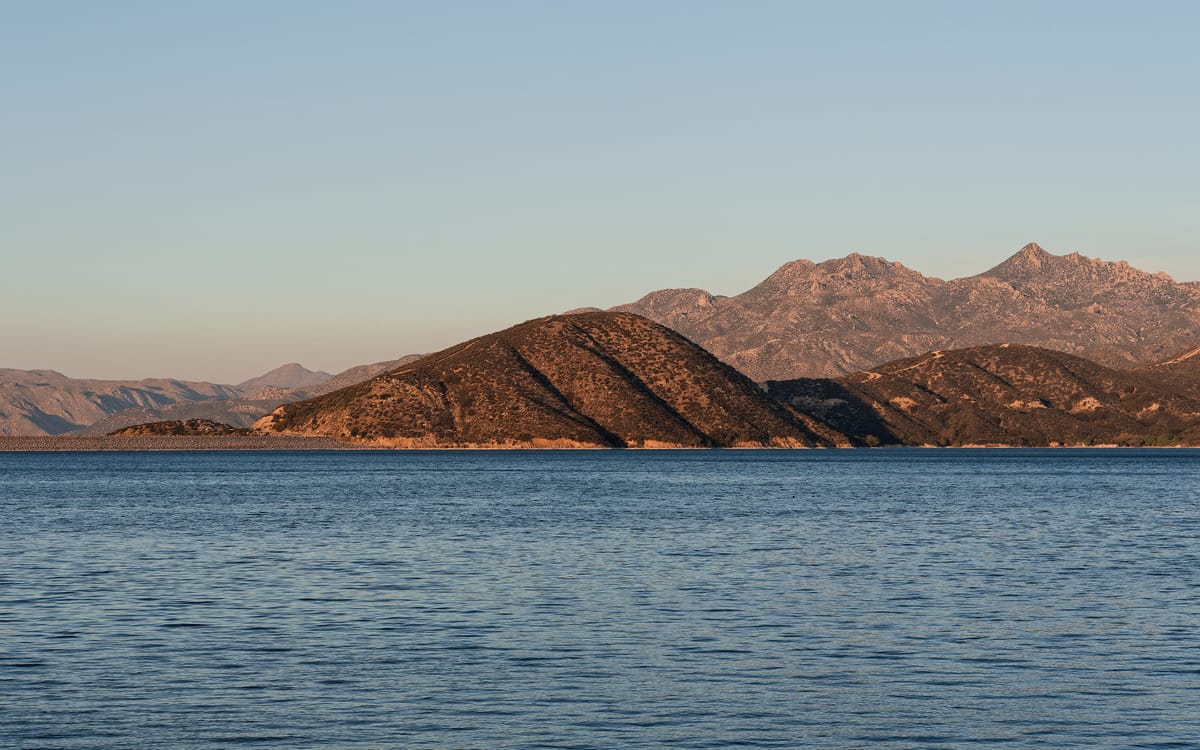
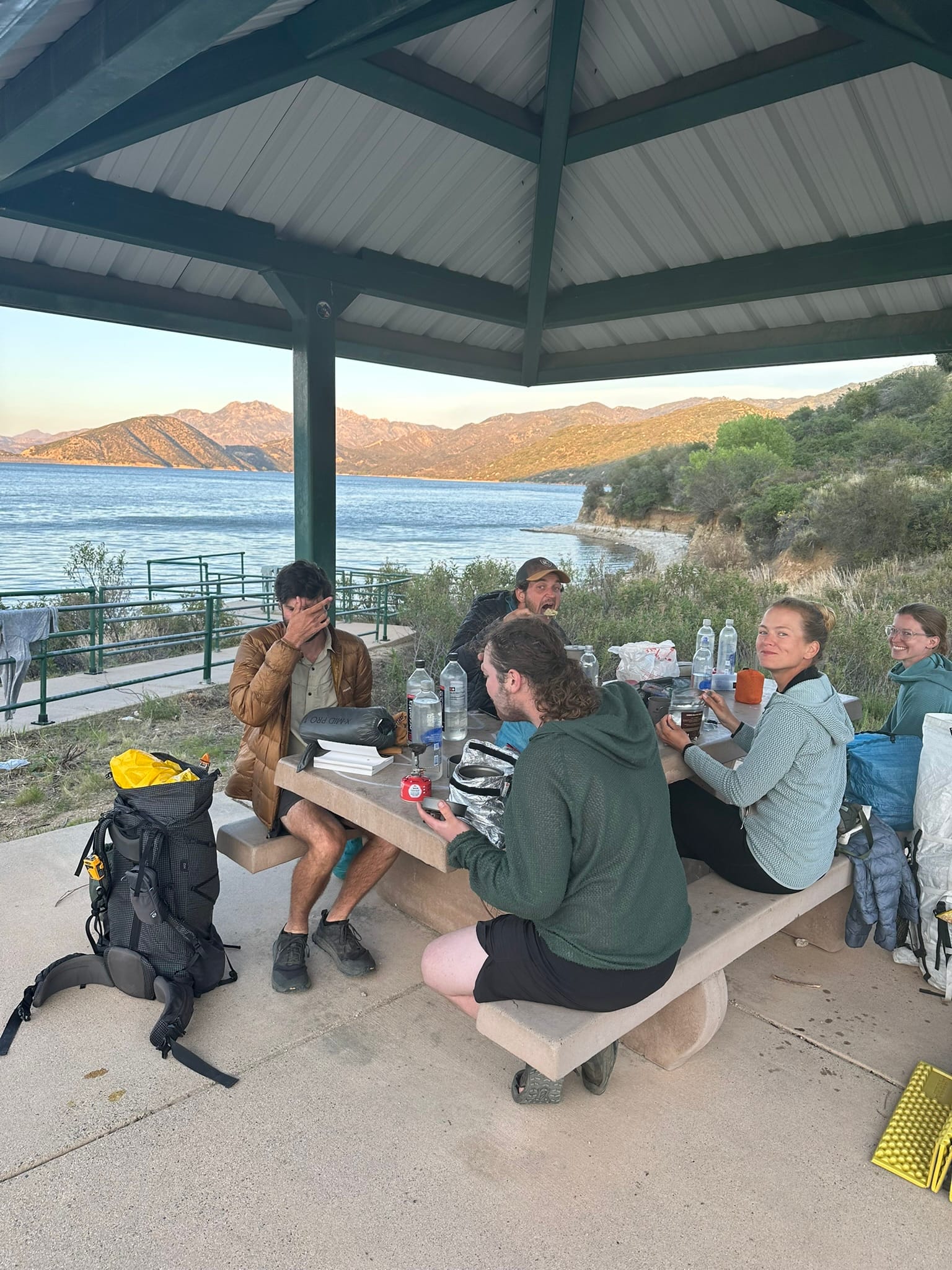
After the bridge, the trail was still friendly, and we cruised on past the Mojave River Forks dam, and then continued to follow Deep Creek until we crossed the road at Highway 173. There we again saw Twig, Masochist, Dario, Deveney, and a few others that we knew. We hiked up the climb with Dario, Deveney, and a Kiwi guy named New Finland. When we got to the top, Anna and I split off for a bit for a water break, and then shortly thereafter ran into a large, angry rattlesnake in its defensive posture. Eventually, I got it to move, but then we ran into the trio who were waiting on a pair of rattlesnakes to move! They had never encountered any before, so I took the lead on checking to see if they were still there. Thankfully, they had already left by the time we got there, so the 5 of us hiked the rest of the day together until we cruised into Silverwood Lake Park (mile 326.4). Once we set our bags down, we quickly set up for the night and went swimming. It was great hanging out most of the day and getting a cold swim in! Silverwood Lake is gorgeous and is a nice reprieve from the desert. 20.5 miles in total today with only 3 snakes seen.
Day 24
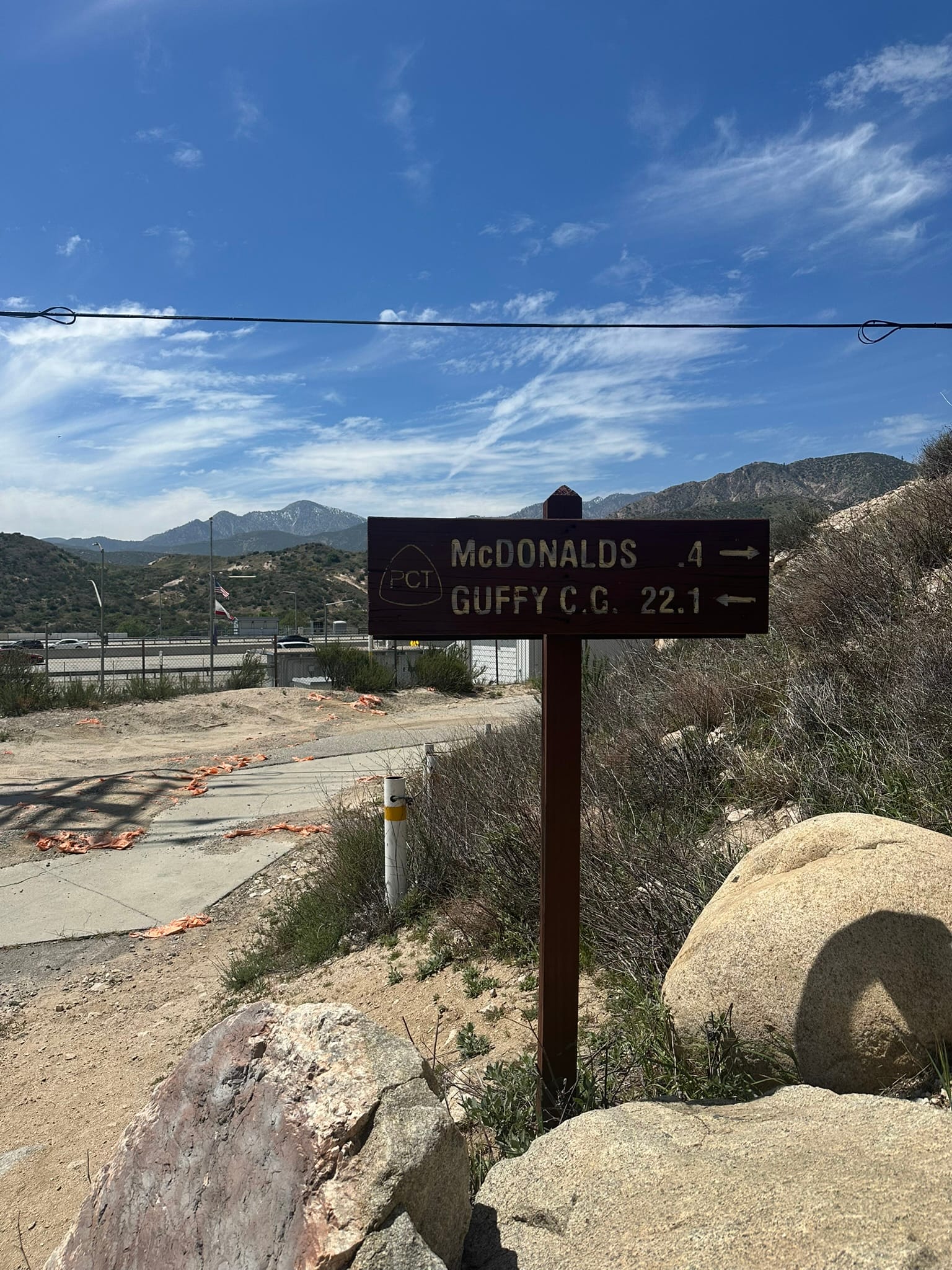
After what was probably my best sleep on trail so far, we woke up at 5am as planned, silently said goodbye to our gorgeous campsite, and hit the trail. As we wound around the lake, we were treated to an incredible sunrise illuminating the clouds, lake, and mountains with beautiful colors. On this side of the lake, the terrain was lush and flowering, so as the sun rose above the horizon, we also enjoyed the blooms. The trail ended up being quite friendly, so we were able to cruise across the terrain easily. Before we knew it, we had covered the 15 miles to McDonald's by 12:30pm!
Happy with our progress, we ordered a bunch of food and got to work planning out our Wrightwood stop. I called and scored us a reservation at the Wrightwood Getaway cabins while Anna sorted out the logistics of getting into town. While we hung out there, a load of other hikers arrived, including our friends that we had camped with the night before. Around 3pm, I packed out a McDouble for dinner, and we hit the trail again for a quick couple of more miles.
This section of trail ended up being pretty cool as we navigated under I15, a large rail bridge, and a massive drainage pipe. We were also treated to spectacular views of the trains and trucks passing by below as we climbed up the rocky outcroppings. We both were feeling tired but in high spirits from our nice day. In the future, we definitely need to work more lunch stops in! At the end of the day, we stopped off to camp at Swarthout Canyon (mile 347.2), and we ran into a bunch of others camped there. All in all, 21.6 miles for today!
Day 25
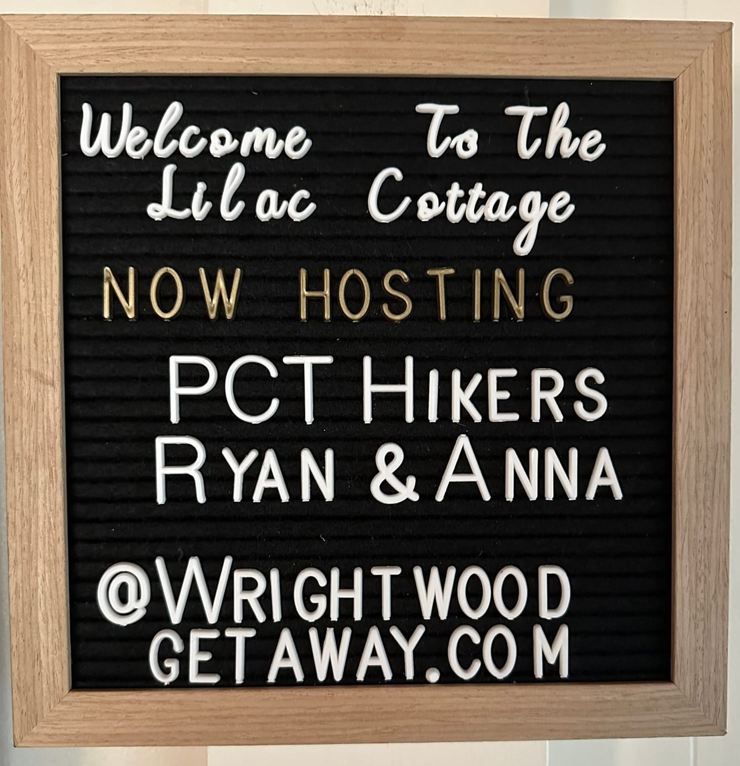
Due to the Bridge Fire closure, we woke up pretty early, knocked out the few miles to the reroute exit, and quickly scored a hitch into town with a nice man on his way into work. Unfortunately, he didn’t speak English, and my Spanish is terrible, so we couldn’t chat, but we still thanked him for his generosity. Once in town, we quickly fell in love with how charming Wrightwood is. We started by grabbing our resupply in the grocery store before heading over to the Grizzly Cafe for a large breakfast spread. The cafe even had a hiker discount! While at breakfast, Arlene, our host, messaged me that the hikers in our room were going to check out later, but that another of their properties was available early for us to check in to. Imagine my surprise when we walked up to a FULL HOUSE to ourselves. It was incredibly cozy and charming, complete with loaner pajamas, a fireplace, and blankets galore. After we had showered and changed into our pajamas, Arlene came by to grab our nasty trail clothes to wash. Finally clean, we relaxed and enjoyed our cozy spot. She had also mentioned that the local Mexican restaurant had a 5 cent margarita special on Tuesdays, so we relayed that info to everyone else.
Once our clothes were returned, we knocked out a few chores, grabbed some snacks, and watched the first half of “Salmon Fishing in the Yemen” before heading off to dinner. When we arrived, practically every hiker we knew was already there, so we sat with New Finland and D&D (the Dutch couple). The food was delicious, and the margaritas were surprisingly decent. Over dinner, we chatted about global politics for hours before Anna and I headed “home” earlyish because we were getting picked up at 7:30am tomorrow. Back at the house, we finished the movie, Anna fell asleep on the couch, and I chugged a Yoohoo before we tucked in for the night. This has been by far my favorite nero, and I absolutely love this house. It’s going to be hard to leave it tomorrow! We stopped at mile 363.4.
Day 26
As expected, I really did not want to leave the house this morning. I woke up a bit tired with a horrible stomach ache from the rich food and drinks yesterday, but stayed committed to leaving early since I knew we had a big day ahead of us, and because it was a tricky ride back to the trail past the closure.
Once our ride arrived with Masochist in it (who was splitting the cost), I said goodbye to the Lilac Cabin, and we were on our way. The driver and I shot the breeze on ski resorts while he wound his way around the mountains. We saw firsthand the devastation of the fire, and weirdly, there were tons of squirrels in the road. The drive ended up being longer than I thought it would be, and unfortunately, I became a bit car sick.
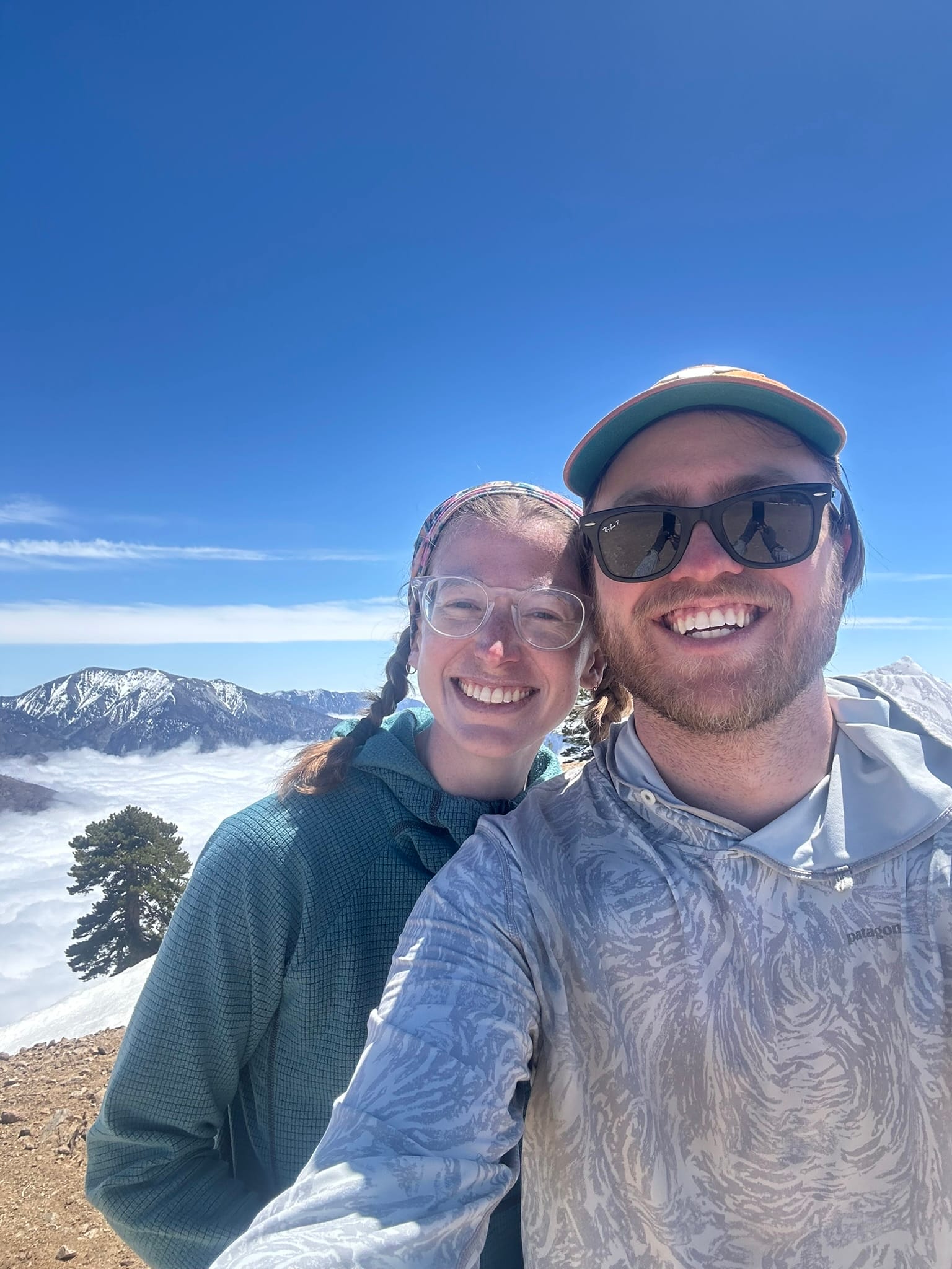
Still feeling under the weather and now nauseous with full food and water, we began the steep 4000ft+ climb up Mount Baden-Powell. I was really dragging up most of the climb, and we had to stop numerous times as the elevation was kicking my butt, but after a few hours, we finally made it a bit after noon. The snow hadn’t been too bad, and the weather was wonderful. We stopped at the top to have lunch and enjoy the gorgeous cloud inversion below us. I was pretty drained and still had no appetite, which was making me feel weak. We then trudged on for a while, navigating overgrown catsclaw and snow, before calling it a day at mile 383.9 at the Little Jimmy Campground. Some Ausies tenting nearby invited us to their fire, so we joined them and traded stories over dinner before a very cold rain blew in and ended the day. We’re now once again wearing all of our layers and shivering in our tent after a whole day of hiking in shorts. Mountain weather sure does change quickly!
Day 27
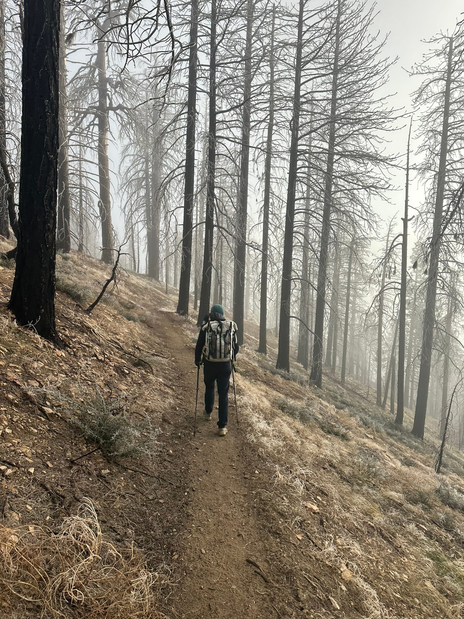
Unfortunately, the clouds never lifted from last night, so it was still quite chilly in damp when we finally found the bravery to leave our cozy quilts. Once packed up, we quickly knocked out the few miles down to Highway 2, but the cold fog had turned into cold rain, and all of the plants were covered in ice. Because the weather sucked and the road was closed, we detoured on Highway 2 instead of the trail for a bit to check out the tunnel at the end. Hopeful that the rain would lift, we plodded on for a while before stopping in at the Eagles Roost picnic area for a cold, damp breakfast. We then rejoined Highway 2 for a few miles to bypass the endangered frog trail closure and then promptly missed where we were supposed to rejoin the trail (along with a few other hikers), so we ended up staying on the road quite a bit longer.
At one point, we stopped by a day-use area, and because we had been able to make more miles due to the unplanned road walks, we took a long break so that Anna could make her first trail coffee of this trail! Thankfully, the weather also seemed to be breaking, so we left our break in high spirits. Once we rejoined the trail at mile 398, it was nice and flat, so we were able to keep up our quick pace. We stopped in at Camp Glenwood to briefly chat with a few other hikers and to shed some layers, and then continued on. Our spirits were pretty high, and we were on track for an early finish, but then the clouds rolled back in and the cold rain began again. We layered up as best we could to stay dry while hiking, but we both still became pretty damp. Not wanting to stop for fear of getting cold, we skipped lunch and continued speed walking for the warmth until we finally found a nice sheltered log under a tree to have a very late lunch.
Rejuvenated from food, we pressed on and decided to take the equestrian PCT route known as the Pacifico Bypass to stay low out of the wind as much as possible. This ended up just being a dirt forest road, which wasn’t too bad to hike but was fairly boring. The socked in clouds also made it so that we couldn’t see a thing over the cliff to our left. We trudged the last couple of miles until we made it to the top of the climb/middle of the reroute, where we eagerly pitched our tent and crawled inside to warm up and dry off near mile 413. All in all, we did about 29ish miles according to my Garmin, but with an overall fairly friendly grade until the end. Nonetheless, this has been by far our biggest day. Fingers crossed we get to see some sunshine tomorrow!
Day 28
We woke up damp and cold; the weather had not changed at all overnight, unfortunately. To make matters worse, our single wall tent was soaked in condensation. Since we felt no reason to get up before the heat, I stayed tucked in for a bit, and Anna made herself some coffee. Post coffee, we packed up our soggy things and hit the trail. The first section of the Pacifico Bypass was all downhill with maybe 20ft of visibility in the dense fog. We made it down to the parking lot next to the Mill Creek Fire Station and used the vault toilet’s roof as shelter while we had breakfast. From there, we waved at the firefighters and pushed on through the mist.
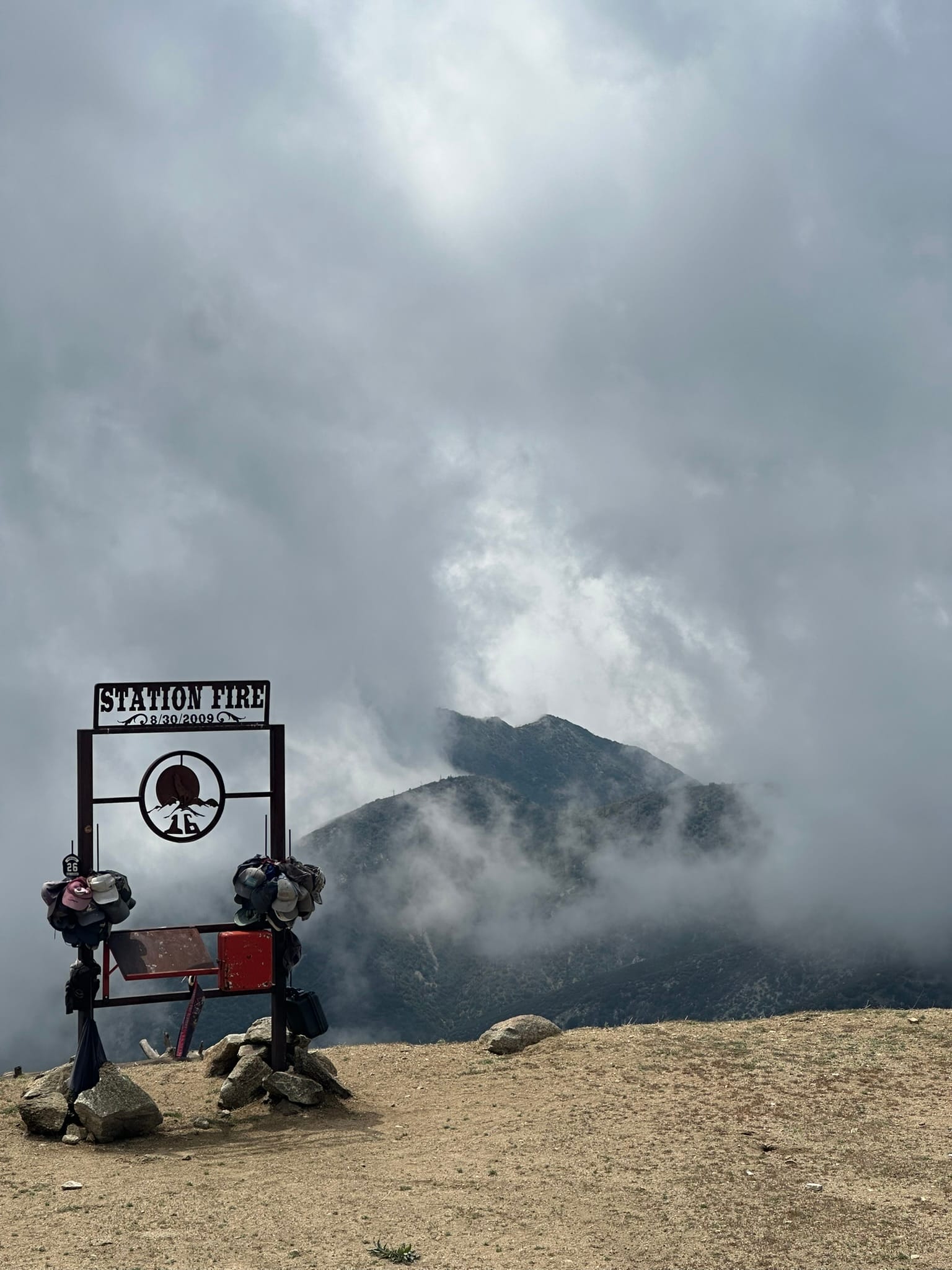
From the fire station, we hopped on a forest road that ran nearish to the trail because we wanted to stop off to see the Station Fire Memorial and to see the old Nike Missile Launch Site LA-04. A few miles out from our lunch destination, the clouds started to break up, and by the time we reached the memorial, we had blue skies. We dried our tent near the memorial while we had lunch, read the plaque and binder on the memorial, and then headed over to the launch site. Between the decommissioning of the site and the subsequent fires, unfortunately, not much remained to be seen, so we headed on our way. We hopped back on trail afterwards, grabbed some water, and cruised the last few miles down to the North Fork Ranger Station. On our steep downhill, I unfortunately twisted my ankle, so I was hobbling around a bit while we set up near the station at mile 436.1. We had dinner with Trip and Chip, another couple that was camped there, before turning in early due to the plummeting temperature. All in all, we did a bit over 22 miles today!
Day 29
Now a familiar pattern, the tent was absolutely soaked when we rolled out of bed from once again sleeping in a cloud. With the knowledge that we would be descending under the clouds shortly, we packed up everything wet and hit the trail. Sure enough, a few miles in and a few thousand feet down, the clouds broke and we were blasted by the familiar hot desert sun. We dropped down around 2000ft over 4 miles, and man, could my ankle injury from the day before feel it. On the way down, we watched an Amtrak train roll by before crossing the valley.
In the valley, we crossed the most foul smelling water source we have encountered yet and decided to pass it by. We also stopped briefly to check out the PCT Completion Monument before starting our big climb of the day. On the way up, we passed these awesome round sandstone formations while we slowly switched our way up the hillside. At the top, we dropped down briefly before resuming our climb. Finally done with climbing, we once again switched our way down the other side and walked through a long drainage tunnel under Highway 14. The graffiti in the tunnel was fairly entertaining, so we stopped to enjoy the shade and take a break from the heat, which had zapped our energy.
Once we exited the tunnel, we were transported to the alien landscape known as the Vasquez Rocks. The “rocks” are famous as a unique geological formation and for being heavily used in movies and TV shows due to their proximity to Hollywood. Despite being beat from the long, hot day, I was stoked to check them out and explore a little bit while we meandered our way through the county park. We passed the famous rock where Captain Kirk fought the Gorn, saw a large gopher snake, and checked out the visitor center before heading on our way.
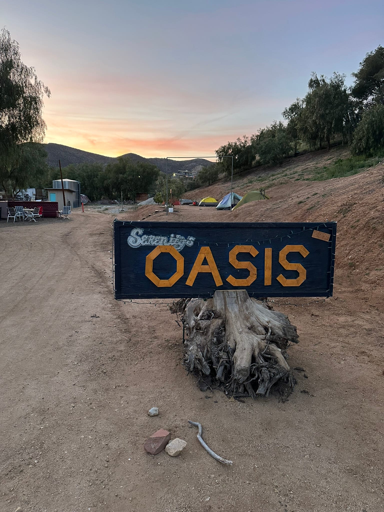
Annoyingly, the trail then turned into a walk on a narrow berm next to a busy road for the remainder of the day. We headed into Agua Dulce, which consisted of maybe 5 businesses on the side of the road. It was then that we realized everything would be closing early due to tomorrow being Easter... Whoops. I grabbed a root beer float, we checked the hours at the Mexican restaurant, and then walked up the road to Serenity’s Oasis at mile 454.7. At first, I was not thrilled with the setup since it just seemed to be a few tents pitched on artificial turf. But then I toured the place and met the owner, Farmer John, and was absolutely blown away by the bathrooms, showers, laundry room, etc. It was clear that it was a labor of love, and that the Oasis was much more than it seemed from the road!
Annoyingly, as I was setting up our tent, I sat down for a second and jabbed myself in the ass with the butt of my ice axe like an idiot. Now further wounded, I was in no mood to do chores. So we headed off to the Mexican restaurant for dinner, and had chips, salsa, margaritas, beer, and massive quesadillas with the Australian sister and brother, Imi and Bush, whom we had had dinner with at Little Jimmy Campground. After dinner, we came back to a dead quiet Oasis, so we tucked in for the night, very happy with how the day had turned out compared to our grumpy morning. Only 19 miles today, but we had done 4200ft down and 2500ft up. No wonder we were grumpy!
Additional photos below: